
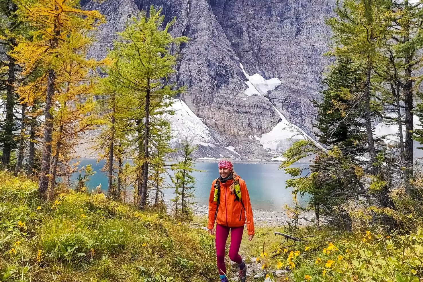
Looking for a perfect day trip from Calgary? We’ve got you covered. Choose from our recommendations of the 15 best hikes near Calgary to get your daily dose of the mountains.
Whether you only want to drive half an hour or don’t mind waking up early and driving further to the beautiful national parks, everyone will find something for their current hiking mood.
This post includes:
- Hikes near Calgary for all fitness levels
- A wide hiking trails selection – lakes, summits, waterfalls, glaciers
- Detailed stats for each (distance, elevation, the best time to go, hike description, etc.)
- Photos of each hike
- Map of hikes for easier planning
- Linked full blog posts to read more about each hike
TIP
If you don’t have a car, some of these hikes are accessible from the nearest town. Read our post about how to get from Calgary to Canmore & Banff.
Table of Contents
A quick overview of all hikes near Calgary
This is a general overview of the hikes based on the difficulty. Everyone’s limits and perception of difficulty is different. I’ve divided all hikes based on our fitness levels – we’re trail runners and active in the outdoors.
I recommend you to read a full blog post (with detailed stats) for the hike you’re planning to do so you have a better idea of what to expect.

Easy hikes near Calgary
- Grotto Canyon (Kananaskis)
- Grassi Lakes (Kananaskis)
- Healy Pass (Banff National Park)
- Johnston Canyon (Banff National Park)
- Boom Lake (Banff National Park)
Moderate hikes near Calgary
- Moose Mountain (Bragg Creek Provincial Park)
- Galatea Lakes and Lilian Lake (Kananaskis)
- Little Lougheed (Kananaskis)
- Ha Ling Peak (Kananaskis)
- Sulphur Mountain (Banff National Park)
- Rockbound Lake (Banff National Park)
- Mount St. Piran (Banff National Park)
Difficult hikes near Calgary
- Aylmer Lookout (Banff National Park)
- Floe Lake (Kootenay National Park)
- Iceline Trail (Yoho National Park)
15 Best hikes near Calgary
All hikes are sorted based on distance from Calgary – closest to furthest.
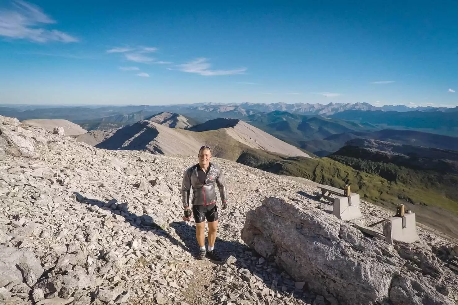
1. Moose Mountain
Distance: 14.5 km return
Elevation gain: 1,060 m
Difficulty: moderate
Best time to go: April to October
Hike description: Located in West Bragg Creek, just 30-minute drive from Calgary, Moose Mountain offers gradual climb on an old fire road. The last part narrows and climbs steeper over the scree.
It’s also a perfect mountain biking trip. The last 1 km is not permitted on bikes so we locked our bikes on the trail marker and continued uphill on foot. The downhill afterwards is a great reward.
Highlights: picnic table and fire lookout on top, mountain biking trail, panoramic views
Distance from Calgary to trailhead: 70 km
2. Galatea Lakes and Lilian Lake
Distance: 18.7 km return
Elevation gain: 806 m
Difficulty: moderate
Best time to go: late June to October
Hike description: One of the most popular hikes in Kananaskis leads to three lakes. There are several creek crossings via wooden bridges – great for filling up your water bottle (only if you use a filter).
The trail is easy and almost flat through the forest to Lilian Lake (6.2 km). Then it steepens over the switchbacks and leads to Lower Galatea Lake (1.5 km) and Upper Galatea Lake (1.6 km to the end of the lake).
Highlights: lakes are great for a dip on a hot summer day, backcountry campground & an option to hike in 2 days
Distance from Calgary to trailhead: 107 km
Full blog post: Galatea Lakes and Lilian Lake Hike
3. Little Lougheed
Distance: 6.3 km return
Elevation gain: 723 m
Difficulty: moderate
Best time to go: April to October (check at the visitor centre for winter conditions)
Hike description: The trail starts following a creek bed, shortly disappears into the forest and crosses a part of the High Rockies biking trail. The trail to Little Lougheed is by the small rock pile and it’s well-trodden.
First part of the trail is very easy passing a mossy area with tiny waterfalls. From the point you reach a big boulder field, the trail steepens and also offers first views of Spray Lakes Reservoir. You will climb uphill, mostly on rocks, all the way up to the top. Last 200 meters are the steepest where you might want to use your hands or hiking poles. The view from the top is breathtaking.
Highlights: view of the Spray Reservoir, almost a year-round hike, great views to effort ratio, very little traffic, panoramic views of surrounding mountain peaks
Distance from Calgary to trailhead: 127 km
Full blog post: Little Lougheed Hike
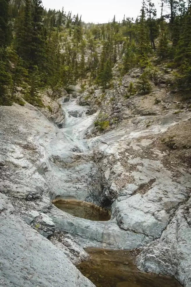
4. Grotto Canyon
Distance: 4.2 km return
Elevation gain: 225 m
Difficulty: easy
Best time to go: year-round, bring microspikes for your shoes during winter
Hike description: The trail starts at the Grotto Lake parking lot. After about 1 km you reach the creek bed and follow it another km to the falls. You can see the ancient pictographs of the canyon walls if you look closely. Continue up the creek bed all the way to the hoodoos.
In winter, it’s a great ice hike walking on the frozen creek bed.
Highlights: ancient pictographs, easy hike with waterfalls to escape the summer heat
Distance from Calgary to trailhead: 93 km
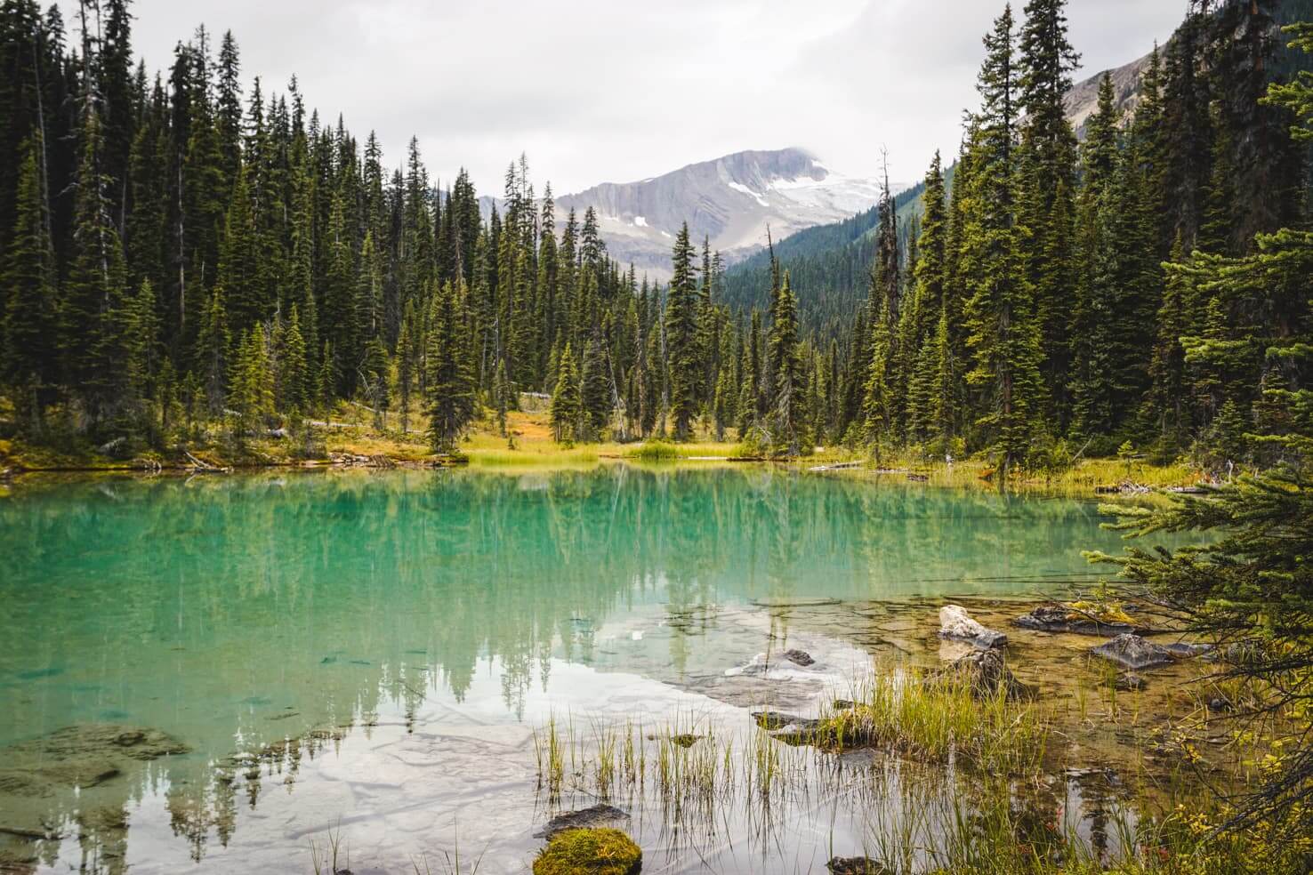
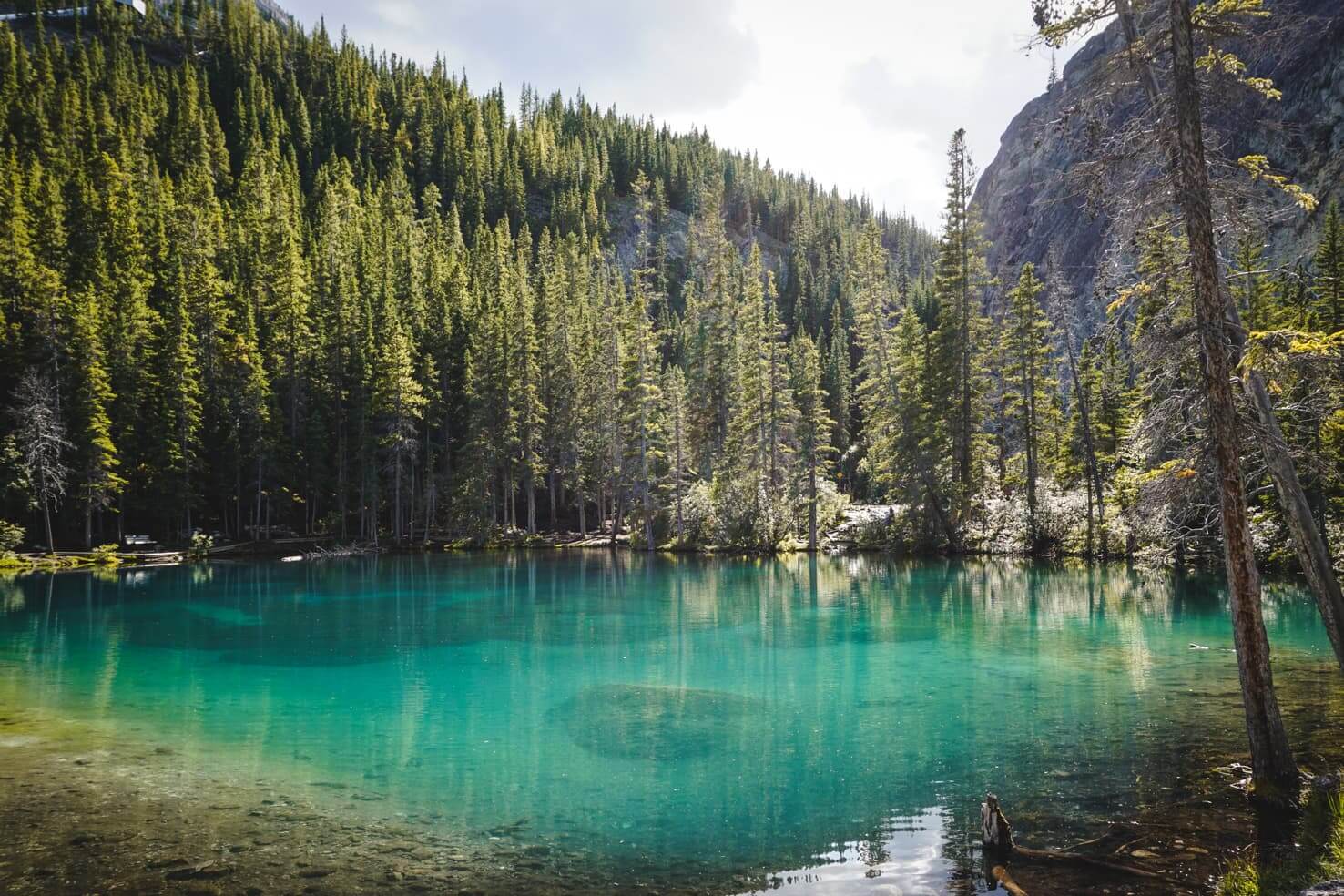
5. Grassi Lakes
Distance: 4 km roundtrip
Elevation gain: 220 m
Difficulty: easy
Best time to go: May to October (check at the visitor centre for winter conditions)
Hike description: Easily accessible from Canmore, Grassi Lakes is a picturesque and short hike. You can choose from two different trails: the easy one is a wide trail through the forest with hardly noticeable elevation and no views, and the harder one is a trail through the forest with a waterfall along the way and a steep part with rock stairs and view of Canmore and Rundle Forebay.
The trail continues around both Lower and Upper Grassi Lakes with breathtaking colours that change based on how the sun’s rays touch their surface.
Highlights: views of Canmore and the Canadian Rockies, blue & emerald green lakes, easy trail
Distance from Calgary to trailhead: 108 km
Full blog post: Grassi Lakes Hike

6. Ha Ling Peak
Distance: 6 km return
Elevation gain: 737 m
Difficulty: moderate
Best time to go: May to October (check at the visitor centre for winter conditions)
Hike description: Close to Canmore, this super popular hike is short, steep and offers amazing panoramic views. Due to the high amount of hikers and erosion on the mountain, the trail has been recently rebuilt and has several portions with steps for easier access. Switchbacks on the mountain make it easier to climb up and (almost) constant views of the valley will keep you wanting to continue.
Once you reach the ridge and see Bow Valley and Canmore, continue to the left to the real summit of Ha Ling Peak.
Highlights: views of Canmore, Bow Valley & Spray Valley; rebuilt trail with no chance of getting lost
Distance from Calgary to trailhead: 111 km
Full blog post: Ha Ling Peak Hike (with neighbouring Mount Lawrence Grassi)
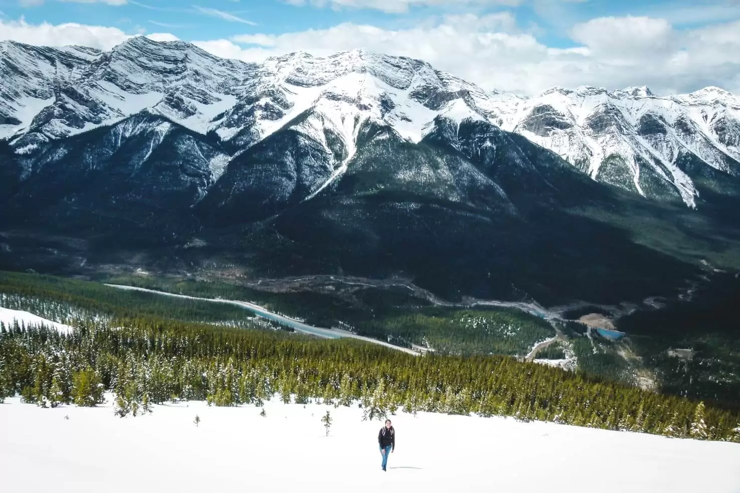
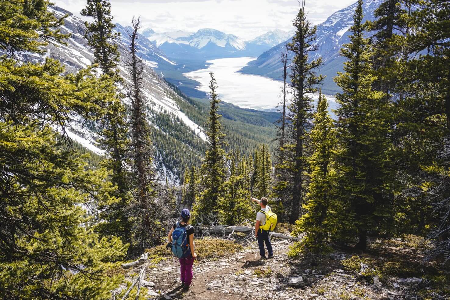
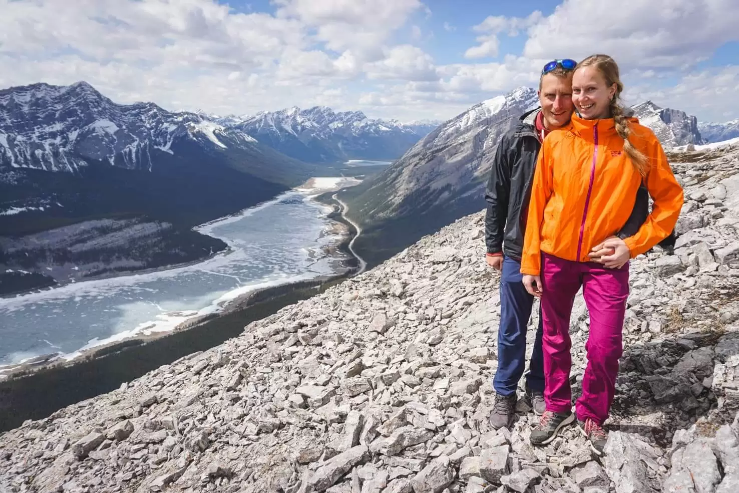
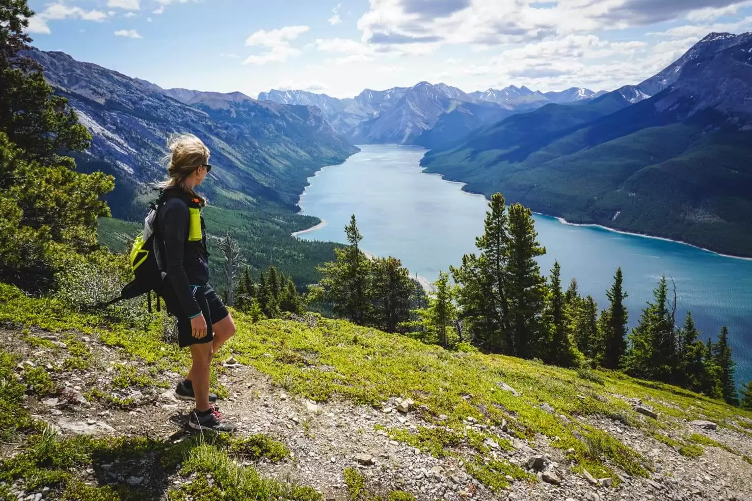
7. Aylmer Lookout
Distance: 25 km return
Elevation gain: 880 m
Difficulty: moderate (if you combine it with bike)
Best time to go: May to October (seasonal restriction in place July 10 to September 15 when no bikes, dogs or camping are allowed and hiking only in a tight group of 4 or more)
Hike description: One of my favourite hikes in Banff National Park starts at Lake Minnewanka parking lot. The first 2 km is flat until Stewart Canyon. Then you follow the shore of Lake Minnewanka on rolling hills on a mix of rocks and dirt until Aylmer Pass Junction. Then it’s about 4 km through the forest and up the hill to the Aylmer Lookout from which you can see almost the whole length of Lake Minnewanka.
There’s also a backcountry campground at the Junction so you can split the trip into 2 days or make it an adventurous day trip the same way we did: 8.5 km mountain bike/8.5 km hike/8.5 km mountain bike.
Highlights: the only hike that offers views of Lake Minnewanka, backcountry campground with an option to make an overnight trip, a great option for a bike & hike trip
Distance from Calgary to trailhead: 132 km
Full blog post: Aylmer Lookout, bike & hike trip

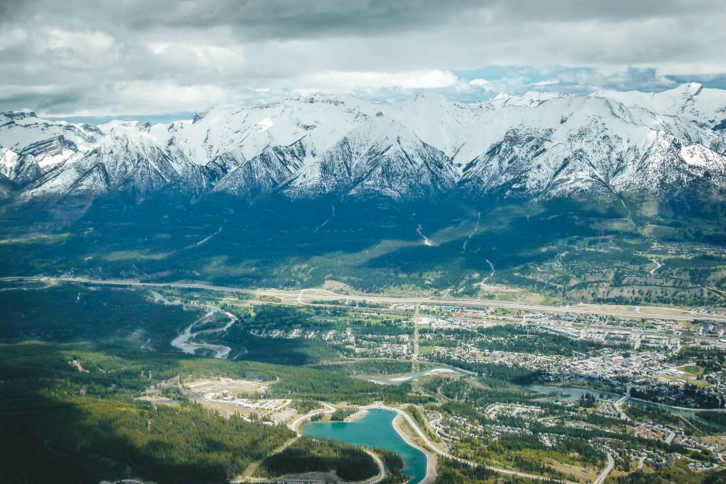
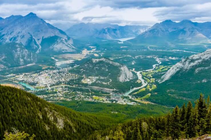
8. Sulphur Mountain
Distance: 11 km return
Elevation gain: 700 m
Difficulty: moderate
Best time to go: year-round
Hike description: The hiking trail starts at the Upper Hot Springs parking lot. Through a series of switchbacks, it climbs gradually to the top of Sulphur Mountain with occasional views of Bow Valley. The trail is well-trodden year-round but bring microspikes for your shoes if you’re hiking in winter. After 4.5 km, you’re on top and can continue 1 km further on the boardwalk to an old weather station.
You’ll see that the never-ending switchbacks are well worth the effort when you see the panoramic views of the surrounding mountains from the top.
Highlights: views of Banff and Bow Valley, saving lots of dollars by not taking the gondola, observation deck on top and option to use the upper terminal to warm up in winter or fill up your water bottle, option to take a public bus or free shuttle to the starting point
Distance from Calgary to trailhead: 133 km
Full blog post: Sulphur Mountain Hike

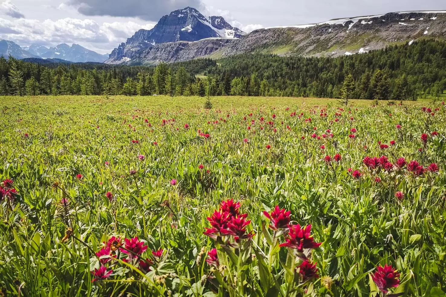
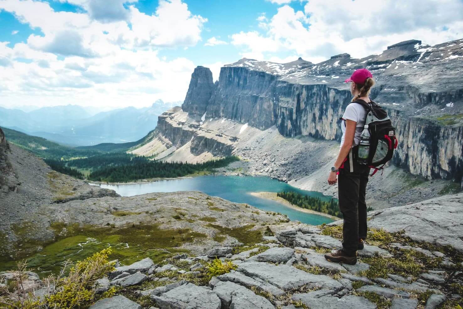
9. Healy Pass
Distance: 19.4 km return (plus 9 km to Egypt Lake)
Elevation gain: 650 m (1060 m if hiking to Egypt Lake)
Difficulty: easy (moderate to Egypt Lake)
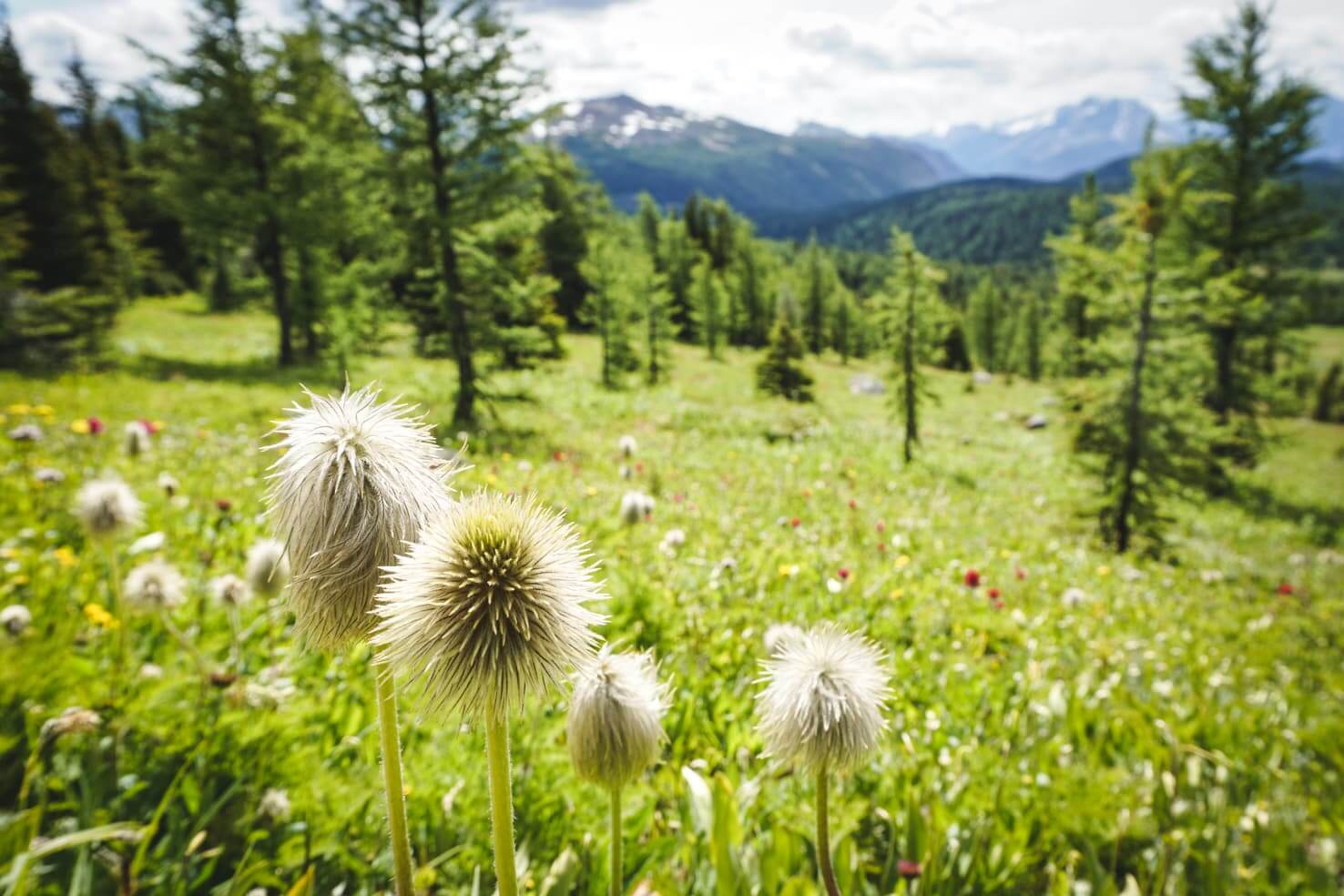
Best time to go: mid-July to September (summer for wildflowers and autumn for yellow larch trees)
Hike description: Starting at Sunshine Meadows, the wide trail follows Healy Creek mostly through the forest while crossing several creeks. About 7 km into the hike, the trail enters a wide meadow full of yellow and pink wildflowers. The sea of colours is in every direction with mountain peaks in the background.
Once you reach the Healy Pass, which is clearly signed, continue another 50 meters up the hill for a view of Scarab Lake and Egypt Lake beneath it. If you feel like continuing, you can hike down from the pass to Egypt Lake, although this part is quite steep as you lose about 300 meters of elevation in 3 km.
Highlights: the sea of wildflowers in summer, easy trail with a gradual incline, option to continue to Egypt Lake for a long day trip or stay overnight at Egypt Lake backcountry campground or a hut, option to fill up your water bottle along the trail (only if you’re using a filter)
Distance from Calgary to trailhead: 144 km
Full blog post: Healy Pass Hike (with Egypt Lake)
10. Johnston Canyon to Ink Pots
Distance: 7.4 km return to Upper Falls (12 km return to Ink Pots)
Elevation gain: 150m; 335 m to Ink Pots
Difficulty: easy
Best time to go: year-round (bring microspikes for your shoes if you’re hiking in winter)
Hike description: Probably the most popular hike in Banff National Park due to its easy trail and accessibility. Starting along Bow Valley Parkway, the flat and paved trail through the forest leads to Lower Falls. You can see them up close through a short rock tunnel.
Upper Falls are 2.5 km from the parking lot and you gain a bit of elevation getting there. The canyon and series of waterfalls are beautiful. Continue 3.5 km further on a wide dirt trail to Ink Pots, a series of five blue-green pools that are cold mineral springs.
Highlights: waterfalls, canyon views, colourful pools Ink Pots, wildlife along Bow Valley Parkway, year-round hike & amazing frozen waterfalls in winter, campground nearby
Distance from Calgary to trailhead: 150 km
Full blog post: Johnston Canyon Hike


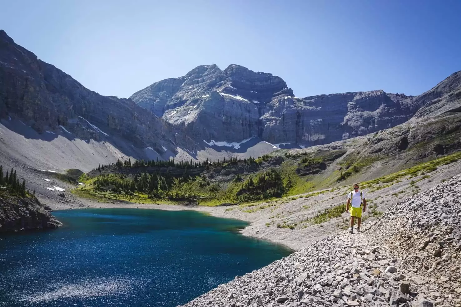
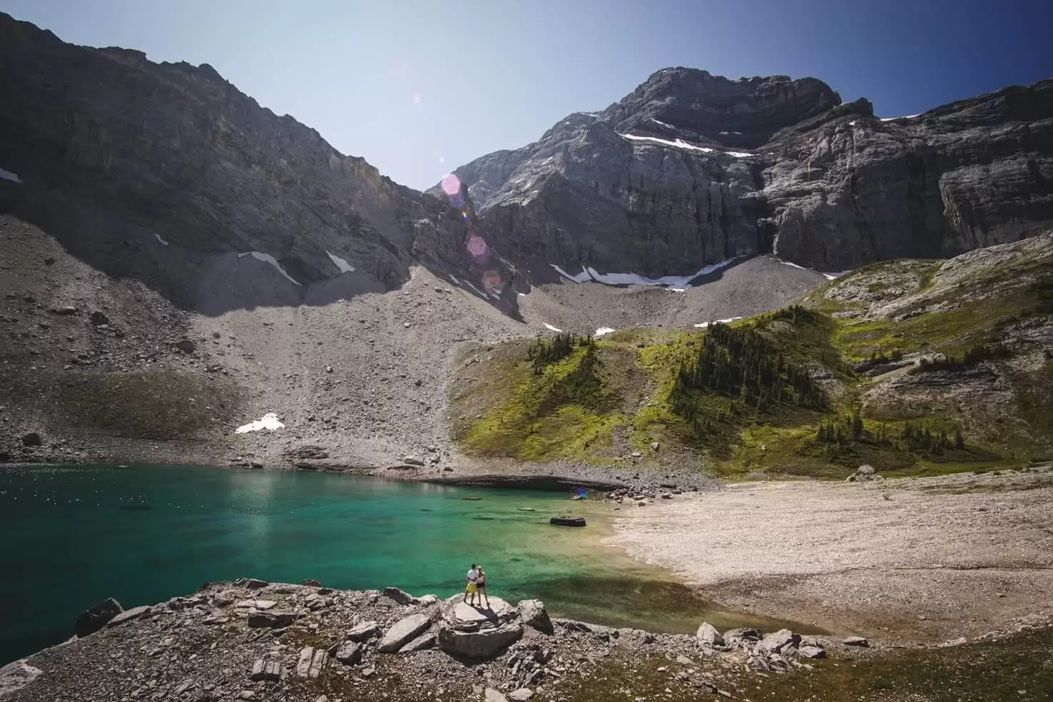
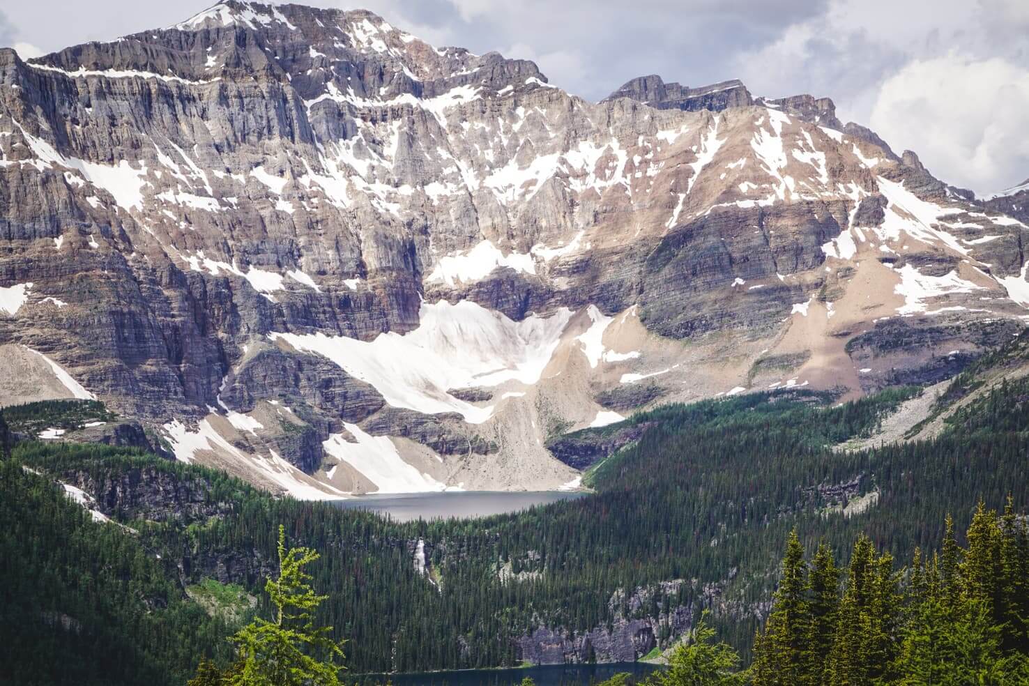
11. Rockbound Lake
Distance: 17 km return (22 km for bird’s eye view of the Rockbound Lake)
Elevation gain: 780 m
Difficulty: moderate
Best time to go: June to September (possible in winter with snowshoes, check Parks Canada website for trail conditions and avalanche danger)
Hike description: Little-known hike starting close to Johnston Canyon in Banff National Park. The trail starts on the old dirt road through the forest and after 6 km, you reach a meadow with Tower Lake. The Rockbound Lake Trail continues to the right across the bridge. Climbing steeper on switchbacks you shortly reach Rockbound Lake.
Continue 2.5 km further up the rock wall on the right for a bird’s eye view of the lake, Castle Mountain and other mountain peaks in the distance.
Highlights: two alpine lakes & great for a quick swim, very little traffic, campground nearby
Distance from Calgary to trailhead: 158 km
Full blog post: Rockbound Lake Hike

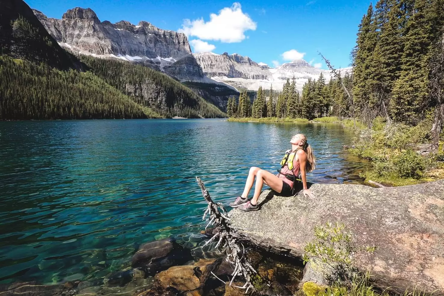
12. Boom Lake
Distance: 10.6 km return
Elevation gain: 200 m
Difficulty: easy
Best time to go: year-round
Hike description: Close to the Alberta-British Columbia border, Boom Lake is clearly signed along 93S/Banff-Windermere Highway. The hike starts at the day-use area with crossing a bridge and on a wide and almost flat dirt trail.
It continues through the forest and narrows when you’re close to the lake. The shore is made of big boulders, some of them big enough to lie down and suntan. I love the crystal clear lake and mountains all around.
In winter, you can cross country ski on the snow-covered lake but don’t go closer to the waterfalls or shore if it snowed recently due to avalanche paths (check the report from Parks Canada before you go).
Highlights: easy trail, picturesque lake at the end, great for a quick swim in summer and cross country skiing in winter, very little traffic
Distance from Calgary to trailhead: 164 km
Full blog post: Boom Lake Hike

13. Mount St. Piran
Distance: 14 km
Elevation gain: 950 m
Difficulty: moderate
Best time to go: June to September
Hike description: Starting at the famous Lake Louise in Banff National Park, the trail follows the Lake Agnes tea house trail and offers occasional views of Lake Louise and Victoria Glacier. After about 3 km from Lake Louise, turn right onto Little Beehive Trail.
You will see the sign for Mount St. Piran on your left. It climbs through the trees and above the treeline where you hike up several switchbacks. Constant views of Lake Louise and Bow Valley offer are always a great reason for a short break.
From the top of Mount St. Piran, you can see glaciers, alpine lakes and mountain peaks of the Bow Valley and along the scenic road Icefields Parkway.
This is one of the best moderate hikes near Calgary which is surprisingly little-known.
Highlights: seeing Lake Louise from above, away from the usual crowds, summit views to different peaks, Lake Agnes and tea house along the way
Distance from Calgary to trailhead: 183 km
Full blog post: Mount St. Piran Hike


14. Floe Lake
Distance: 22.2 km
Elevation gain: 1,000 m
Difficulty: difficult
Best time to go: June to October
Hike description: Lesser known hike in Kootenay National Park, British Columbia is usually done in two days and staying overnight in a campground. We went for a trail run and met a few others hiking it in a day.
The narrow trail starts through the trees and shortly reaches a wooden bridge across the turquoise Kootenay River. It gradually inclines n short switchbacks followed by longer flat sections. You can see the mountains around until you reach a waterfall, at about 8th km from the start. The trail steepens significantly as you slowly climb the switchbacks.
About 3 km later when you reach a flat trail again, you’re almost at the campground and the lake. Floe Lake has a huge rock wall behind it, the biggest I’ve ever seen, giving the lake a breathtaking impression.
Highlights: little traffic on the trail, raspberries, huge picturesque alpine lake, backcountry campground and an option to stay overnight, moist air and greenery are always pleasant in British Columbia
Distance from Calgary to trailhead: 189 km
Full blog post: Floe Lake Hike

15. Iceline Trail
Distance: 18.3 km loop via Celeste Lake (22.3 km via Stanley Mitchell Hut/Little Yoho Valley Trail)
Elevation gain: 793 m
Difficulty: difficult
Best time to go: mid-June to mid-October (outside these dates the road is closed due to avalanche danger)
Hike description: Starting at the famous Takakkaw Falls in Yoho National Park, the loop can be done in both directions. We chose to hike via Whiskey Jack Hostel because the beginning is steep, and it’s better for the knees to go uphill, rather than downhill.
Several switchbacks leading through the trees quickly gain about 500 m of elevation. Above the treeline, the gorgeous views start. First Takakkaw Falls with the glacier feeding them above, then several glaciers and waterfalls in the distance. And after hiking for a few km on the rocky trail, you reach glacier upon glacier right next to you.
Once you stumble upon an alpine lake with a sign, continue to Celeste Lake Trail for a shorter version or to Stanley Mitchell Hut for a longer version/overnight stay. The Celeste Lake Trail offers a complete change of scenery with green meadows, lots of moss and mushrooms. You descend through the forest and pass three green alpine lakes. On the bottom of the Little Yoho Valley, there are refreshing Laughing Falls before you hike the last 4 km on a flat trail back to Takakkaw Falls.
This is one of the best hikes in the Canadian Rockies with lots of natural wonders along the way!
Highlights: hiking right underneath glaciers, several alpine lakes, waterfalls, bird’s eye view of Takakkaw Falls, distant views of glaciers, option for a backpacking trip and staying in backcountry campground or an alpine hut
Distance from Calgary to trailhead: 217 km
Full blog post: Iceline Trail in Yoho


Tips for hiking near Calgary
What to pack for hiking near Calgary
Read our recommended Hiking packing list for the Canadian Rockies. The three most important gear I always carry is:
- bear spray
- lifestraw water bottle with filter
- windproof jacket
Our favourite hiking trails in the Rockies
- Hiking in Jasper National Park: 17 best hikes for all levels
- 20 best hikes in Banff National Park
- Hiking in Yoho National Park
- Hiking & camping at Lake O’Hara: the complete guide to Yoho’s paradise
More day trips from Calgary
- Road Trip through Southern Alberta
- Traveling back in time in Drumheller
- 47 fun outdoor things to do in Canmore
- 11 Best places for stand up paddleboarding in Banff & around
- The ultimate guide for visiting Moraine Lake
- 14 Awesome bike trails around Banff
National park fees
Several of the listed hikes are located in Banff, Yoho, or Kootenay National Parks. When you enter any national park in Canada, you’re required to pay an entrance fee. You have a choice of either a daily pass or a yearly pass.
- 10.50 CAD per person for a daily pass, 21 CAD for a group/family
- 72.25 CAD per person for a yearly pass, 145.25 CAD for a group/family
The yearly Discovery Pass is valid for all National parks in Canada. You can purchase it at the gate when you enter the national park, in the Visitor’s Centre or online here.
TIP
If you haven’t ordered your park pass online in advance, when driving from Calgary, stop at the visitor centre in Canmore along Trans-Canada Highway. It will save you a lot of time at Banff National Park gates where you can spend hours in summer.
Kananaskis Conservation Pass
All vehicles parking at the provincial park and on public land in Kananaskis Country and the Bow Valley must purchase a Kananaskis Conservation Pass. You can buy it online or in-person at Kananaskis Visitor Centers & Canmore Nordic Centre. The day pass costs 15 CAD for one vehicle, and the yearly pass costs 90 CAD for two vehicles.
From our list of hikes near Calgary, you need Kananaskis Conservation Pass for hiking Grotto Canyon, Grassi Lakes, Galatea Lakes and Lilian Lake, Ha Ling Peak, and Little Lougheed
It’s free if you visit on Wilderness Wednesdays, the first Wednesday of every month.
Staying in the Rockies
To have the most freedom and enjoy nature to the fullest while staying on a budget, we always recommend staying in the campgrounds. Check out our Smile Campervans; a great way to immerse in nature and have your home on wheels in the Canadian Rockies.


Check out our comprehensive camping guide for Banff National Park & beyond to see all options.
Road closure
You can check accurate road conditions here for Alberta and here for British Columbia.
Trail report
Before you go hiking, whether in summer or in winter, check these websites beforehand for current trail conditions:
Bear country
As always in the Canadian Rockies, you are in bear habitat. You should always carry a bear spray (can be purchased at Visitor’s Centre or outdoor stores), know when and how to use it and make noise while hiking and running (so you don’ surprise any bears)! Carefully read these instructions on how to behave around them.
What is one of your favourite hikes near Calgary? Have you tried other amazing day hikes near Calgary? Share with us in the comments.
Spread the word! PIN this to your Pinterest board.


Have fun!