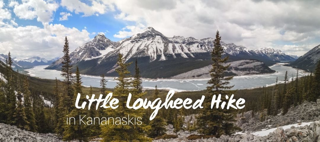
While Banff and Jasper receive a fair amount of visitors every hiking season, there’s much more to the Canadian Rockies. Let me tell you about Kananaskis Country and one of the lesser-known hikes – Little Lougheed Hike.
Kananaskis Country lies west of Calgary and it’s the entrance gate to the Canadian Rockies. With only an hour’s drive from the city, it’s a favourite hiking spot for locals and visitors who look for off the beaten path.
If you look at the peaks of the Rockies, no wonder people are drawn to summit hikes more than anything else. And Kananaskis has plenty of them.
Little Lougheed Hike has one of the best views to effort ratios. What else can you ask for?
Other popular hikes in the area:
For more hiking ideas in the Canadian Rockies, read these:
- 15 best day hikes near Calgary
- Fun outdoor things to do in Canmore
- 20 best hikes in Banff National Park
- Hiking in Yoho National Park
- 17 best hikes in Jasper National Park
Pros & Cons of the Little Lougheed Hike
Pros:
- Short distance hike
- Almost a year-round hike
- Panoramic views of surrounding summit peaks
- Very little traffic
- No cliffs or dangerous parts
- Easy scramble at the top for beginners
- Optional dip in the refreshing Spray Lakes Reservoir
Cons:
- Steep trail
- Trailhead is 24 km from Canmore on a very dusty and bumpy dirt road
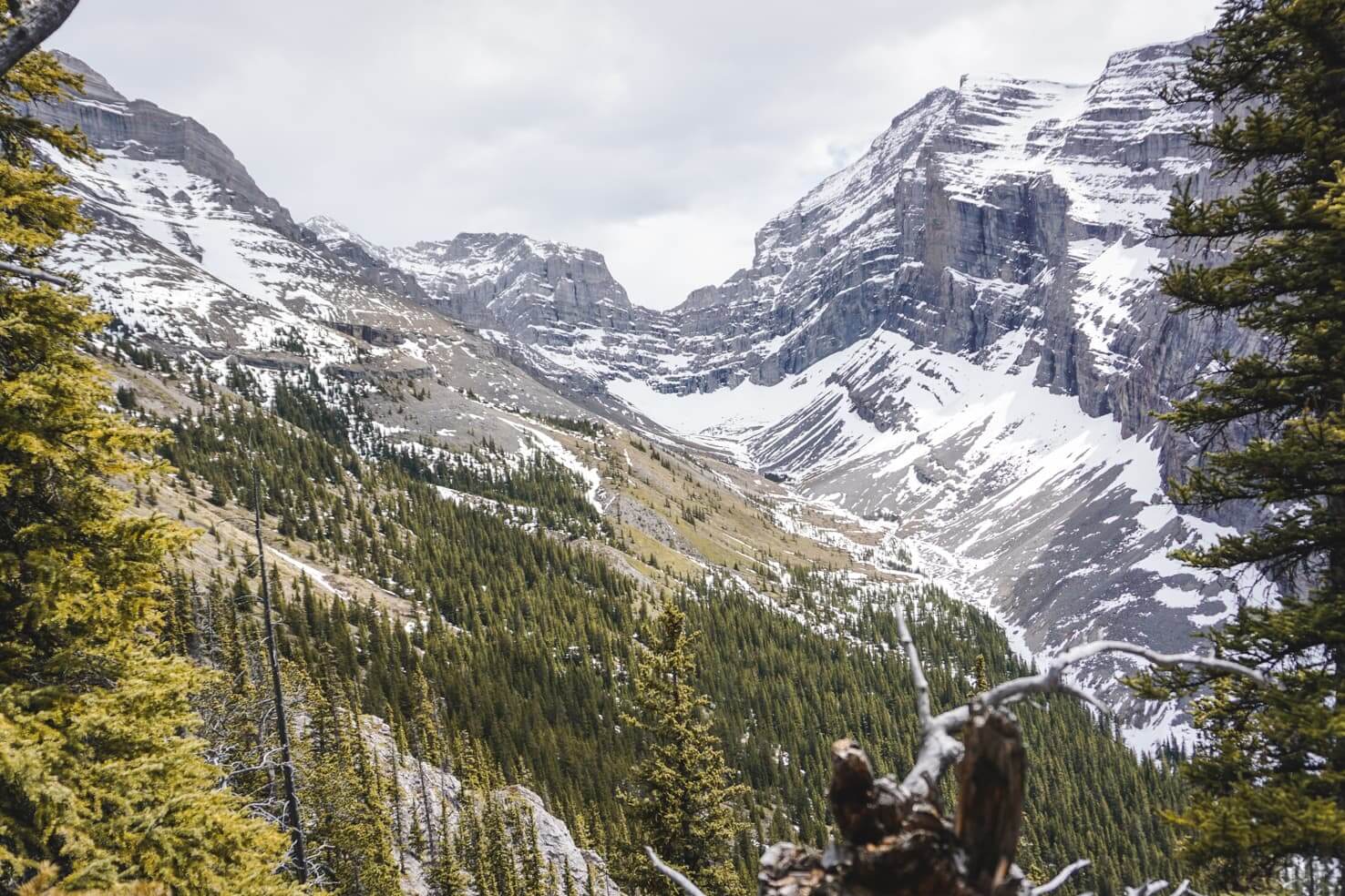
The view of Mount Sparrowhawk on the way to the top
Where is Little Lougheed Hike
Little Lougheed is located in the Spray Valley Provincial Park in Kananaskis. It lies in the shadow of its big brother Mount Lougheed.
The trailhead is located on the Smith Dorrien Trail, approximately 24 km from Canmore. It’s right next to Spencer Creek, which was only a creek bed full of boulders when we visited. You will see the creek on the left side when driving from Canmore. It is not marked so make sure to look at the photo and map below.
How to get to Little Lougheed Trail
There is no public transport whatsoever so you would need to drive there yourself. From Canmore, follow signs to Canmore Nordic Centre on Three Sisters Parkway/Smith Dorrien Spray Trail. After you pass the Nordic Centre, the paved road becomes a dirt road. Depending on which time of the year you visit, the road is quite bumpy and dusty (make sure your windows are closed).
After a short drive uphill, you will see a big parking lot on the right side for Goat Creek and Ha Ling Peak hike, keep driving until you reach Spray Lakes Reservoir. The trailhead is at about 1/3 of the reservoir. You can park on the roadside. There is no sign so the best thing you can do is to follow the pin on the above google map.

Parking on the roadside right next to the creek bed is the only option
Little Lougheed Hike
- Distance: 6,3 km return ( ̴ 4 hours, it took us 5 hours including all the breaks)
- Elevation gain: 723 m
- Maximum elevation: 2430 m
- Difficulty: moderate (although it’s steep, there are no dangerous parts)
- Best time to go: April to October (ask at the visitor centre for winter conditions)
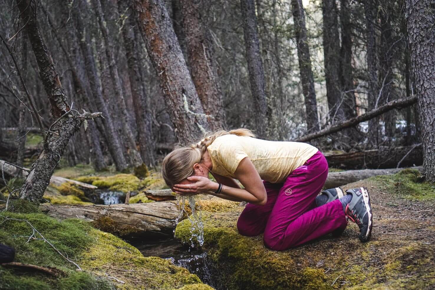
- Gear: windproof jacket, running/hiking shoes, water (the only source of water along the trail is the tiny creek at the beginning), gaiters in early spring, possibly hiking poles and spikes
-
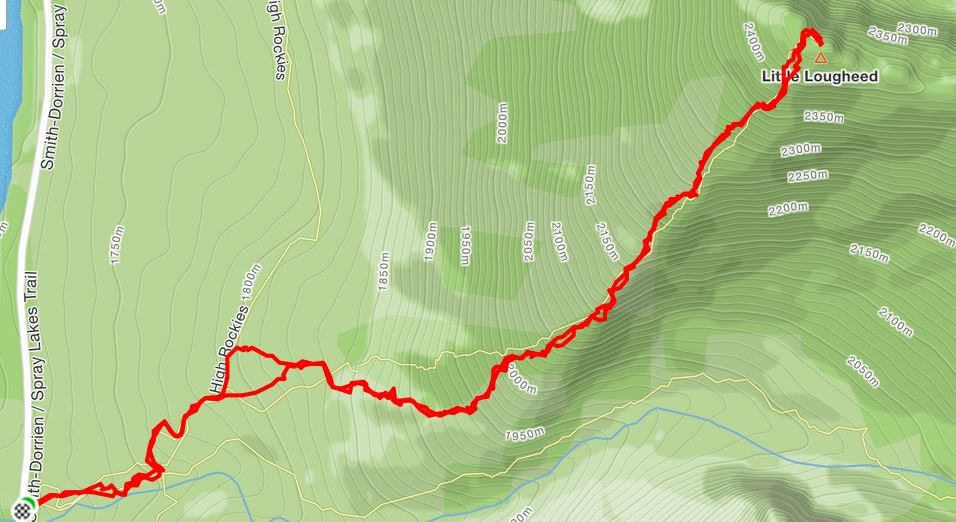
- GPS route of our hike
-

- Profile of the trail – 1000m elevation gain in 3km
The trail starts on the left side of the creek and slowly disappears into the forest. It’s well-trodden and visible but don’t expect any signs on the trail. We’ve followed these GPS instructions, it might be a good idea to have them on your phone.

Trailhead is visible from the roadside
After about 5 minutes on the trail, you will see two wooden bridges which are part of the newly built High Rockies Trail. Cross the left bridge and continue on the 1-meter wide High Rockies Trail. When you see a pile of rocks on the right, leave the High Rockies Trail and continue through the forest. It’s a very easy and relaxing uphill trail on soft dirt.

Crossing the bridge on the High Rockies Trail

Pile of rocks indicating the way up
The first little surprise is waiting. Enchanted fairy tale-like forest with a lot of moss and a tiny creek with tiny cascading waterfalls. We spent here quite some time taking pictures and enjoying the beauty.

We called it a fairy tale forest
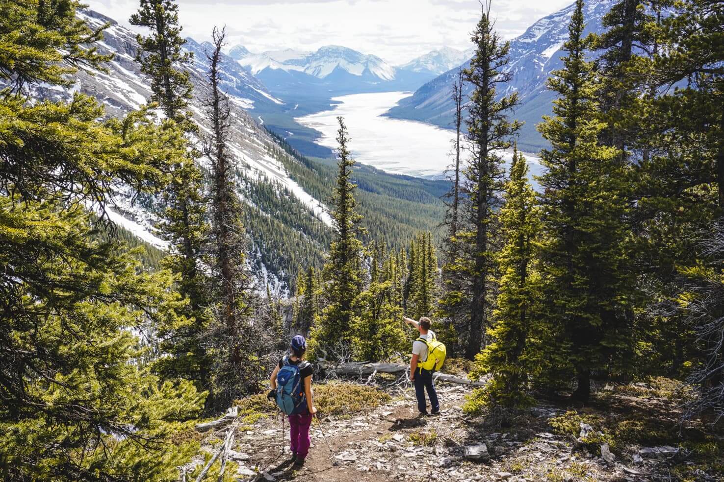
About half an hour later, you will leave the forest behind and reach the boulder field. The trail steepens and it’s straight uphill from here. You can easily avoid going through the boulders and pass them on the right side. The second surprise is right here when you turn around. Views of the Spray Lakes Reservoir open up.

Hiking around the boulder field

Views open up from the boulder field
Once again, a little trodden trail will lead you into the forest. The dirt trail is mixed with the rocks and soon the rocky trail will become your companion all the way to the top. The views will make up for the steep and tiring uphill as you will see the whole valley open up.

The trail changes from dirt to rocks a few times
When we hiked in May, there were only a few patches of snow on the trail and we didn’t need spikes or gaiters (even though we carried them), and the trail was quite visible.
We still heard a few falling avalanches in the distance towards Mount Sparrowhawk.
The last 200 meters is the steepest and a short scramble where you will need to use hands (or hiking poles). Although the scree was a bit slippery, you can choose whichever path you like. I hiked up the bigger rocks and didn’t have the slightest issue with my feet slipping.

The last section looks like this
Early season conditions but we didn’t even need gaiters or spikes
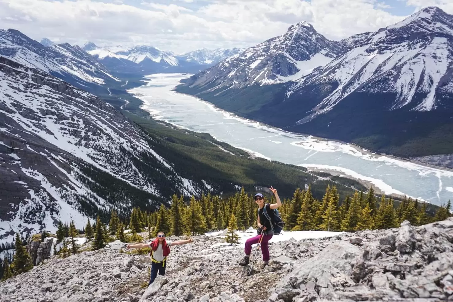
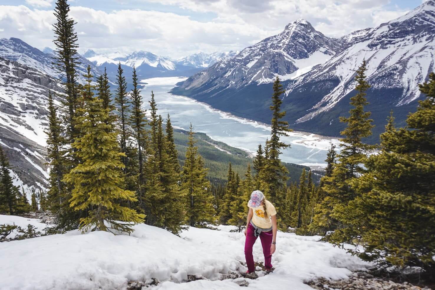
The top of Little Lougheed delivered everything I imagined and more. Panoramic views of mountain peaks all around us with a bird’s eye view of the long Spray Lake Reservoir below.
Enjoying the summit views

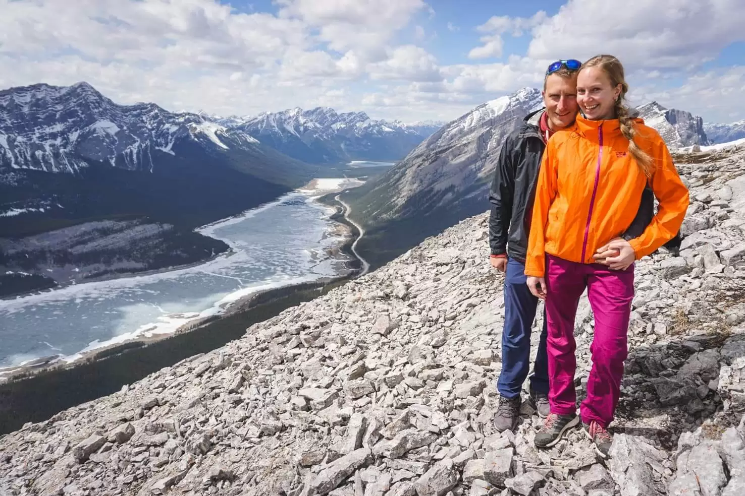
Panoramic view from the top – Mount Lougheed on the left and Mount Sparrowhawk on the right
We celebrated reaching the summit with special cookies sent all the way from home in Slovakia. They always taste best after physical activity. After admiring the views and embracing the sun and wind, we happily headed back down.

Only Slovaks understand this pleasure
Even though we passed the enchanted fairytale forest on the way down, we somehow ended on a different part of the High Rockies Trail. But from there it was straightforward to continue out of the forest.
A great half-day hike with legs strengthening and panoramic views!
Looking at avalanches on the way down
Little Lougheed in winter
Even though we’ve hiked in early spring (yes, May in the Canadian Rockies is early spring), we’ve seen reports of people hiking all year round. The trail can be hiked with crampons or snowshoes and nearing the top, it’s usually so windy that the boulders are windswept. Sharpen your route finding skills if you head up, the trail in winter is covered with snow.
Tips for Little Lougheed Hike
Road closure
For accurate road conditions (or seasonal road closures due to wildlife presence or avalanche dangers) in Kananaskis, check out this website.
Trail report
Check trail report for Kananaskis Country before hiking for possible closures. You can download a basic hiking map for Kananaskis Country here.
Packing list for Little Lougheed Hike
Our hiking essentials include:
- Paper map of the area and downloaded map of the hike on the phone
- External battery for the phone (especially for using GPS on the phone)
- Lifestraw water bottle with a filter so we can drink from anywhere
- Extra snacks
- Windproof & waterproof jacket (yes, in summer as well)
- Fleece or down jacket as unexpected snowstorms happen in summer
- My absolute favourite trail running shoes
- Bear Spray
And a few other items as well. For a full list of our gear, check out our hiking packing list for summer in the mountains. You can see the full list with links to purchase our favourite gear on our Amazon page.
The joyful ending of a hike
Kananaskis Conservation Pass
For hiking Little Lougheed, you need to purchase a pass. All vehicles parking at the provincial park and on public land in Kananaskis Country and the Bow Valley must purchase a Kananaskis Conservation Pass.
You can buy it online or in person at Kananaskis Visitor Centers & Canmore Nordic Centre. The day pass costs 15 CAD for one vehicle, and the yearly pass costs 90 CAD for two vehicles.
It’s free if you visit on Wilderness Wednesdays, the first Wednesday of every month.
Bear safety
If you’re hiking in the Canadian Rockies, you’re hiking in a bear country. You should always carry a bear spray (can be purchased at Visitor’s Centre or outdoor stores), know when and how to use it and make noise while hiking (to let bears and other wildlife know that you’re there so you don’t scare them)! Carefully read these instructions on how to behave around bears.
Our favourite hikes in the Canadian Rockies
Banff National Park:
- Sulphur Mountain
- Johnston Canyon in summer and in winter
- Rockbound Lake
- Aylmer Lookout
- Glacier Lake
- Mount St. Piran
- Healy Pass
- Boom Lake
Jasper National Park:
Yoho National Park:
Kootenay National Park
Travel guides for planning your trip to the Canadian Rockies
- Epic travel guide to the Canadian Rockies
- 100 things to do in Banff National Park
- Western Canada road trip itinerary for 2 weeks
- Adventure travel guide to Banff National Park
- Icefields Parkway, scenic road trip through the Rockies
Spread the word! PIN this to your Pinterest board.