
While Ha Ling Peak Hike is the most popular in Canmore, its neighbour Mount Lawrence Grassi offers the same views without the crowds on the trail (but it’s not easy). Read our comparison to choose which one is best for you.
Hiking in the Canadian Rockies is more popular than hockey. I’m serious! People play hockey, even more people watch hockey but it seems to me that everybody is hiking. Canada made us hikers, too.
Read these comprehensive travel guides to plan your trip to the Canadian Rockies:
- Epic travel guide to the Canadian Rockies
- 100 things to do in Banff National Park
- Western Canada road trip itinerary for 2 weeks
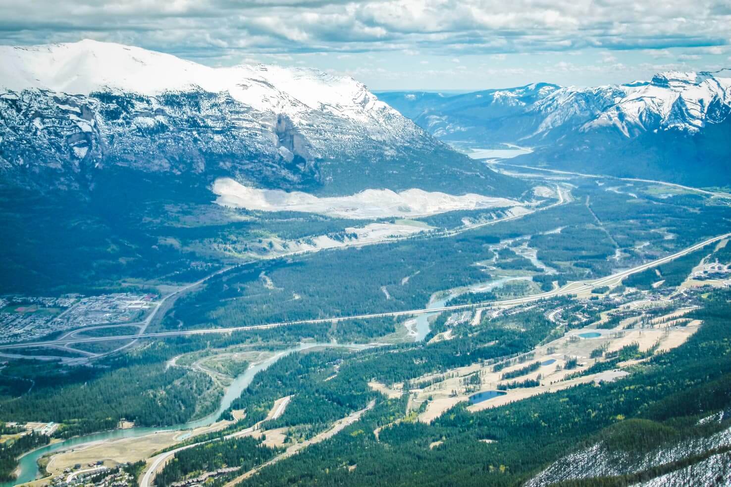
view from Ha Ling Peak towards Calgary
In Calgary, where we live, people call the Canadian Rockies their backyard. Even though they are 80 km away, locals consider them being at their doorstep. Given the distances in Canada, you might say the Rockies are close. So it’s not hard to understand why so many people go to the mountains whenever possible.
Hiking in the Rockies
Ha Ling Peak was the first mountain we reached when we came to Canada and the only mountain peak we’ve summited 3 times already. It’s safe to say we were hooked and hiking ever since. We summited the little known neighbour Mount Lawrence Grassi the same season. And we didn’t stop there.
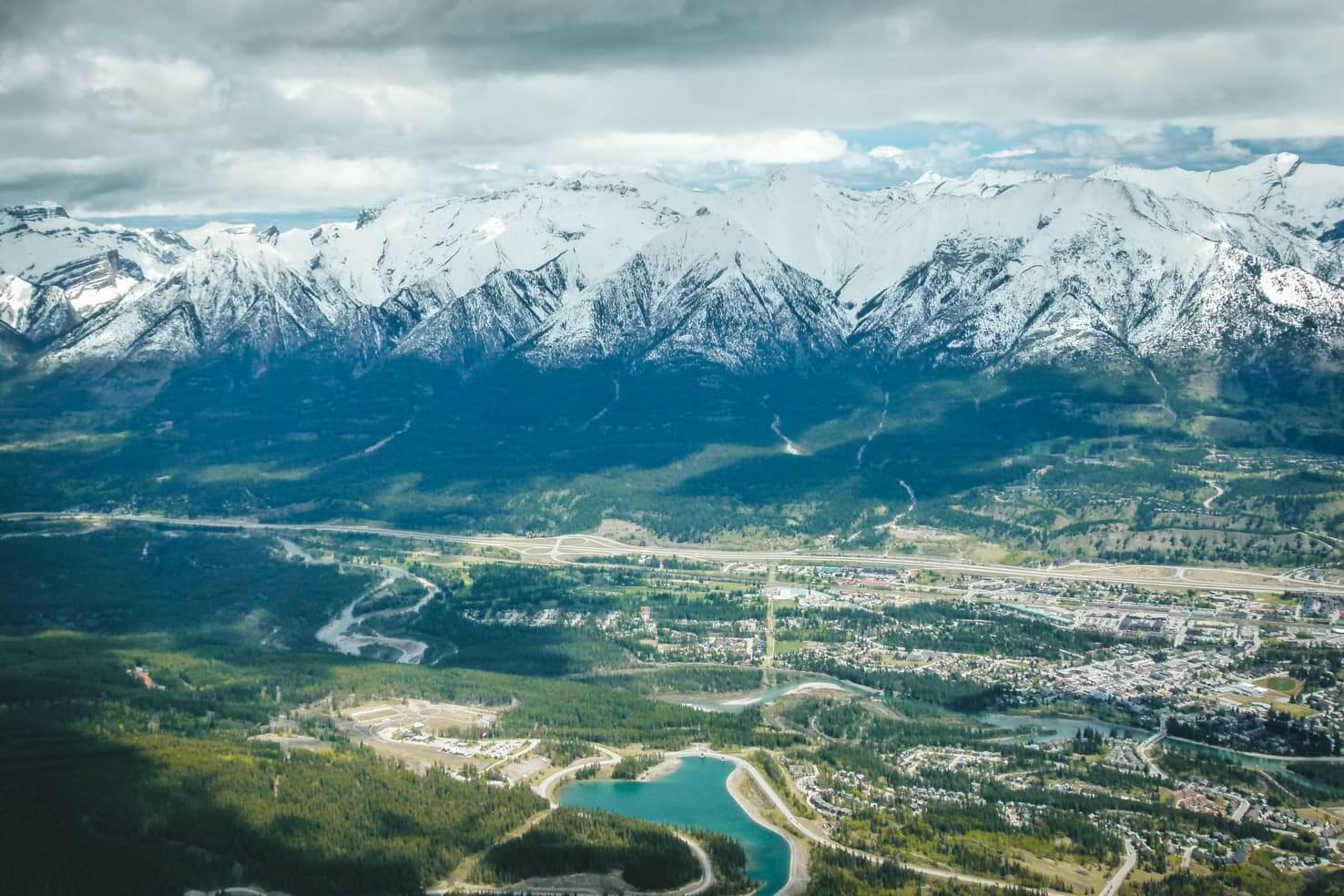
view from Ha Ling Peak on the town of Canmore
Our favourite place for outdoor activities is Canmore, only an hour away from Calgary. The little neighbouring town of Banff, just before Banff National Park. Since Canmore doesn’t belong to the national park and is not on every brochure about the Canadian Rockies, it gets fewer tourists and therefore feels more authentic than Banff.
We did these hikes quite some time ago and they remain my favourites. They are next to each other, you can choose whichever based on your abilities and mood. Don’t let the lack of signage in the Canadian Rockies discourage you from hiking, just make sure to read trail reports before heading out.
TIP
Check trail report for Kananaskis Country before hiking for possible closures. You can download a basic hiking map for Kananaskis Country here.
Ha Ling Peak Hike vs Mount Lawrence Grassi in a nutshell:
Ha Ling Peak
- Moderate hike, suitable for beginners
- 6km ( ̴3,5 hours)
- Elevation gain 737m
- Very busy during the day
- Well beaten path
Mount Lawrence Grassi
- Difficult hike
- 9,8km ( ̴6 hours)
- Elevation gain 1,022m
- Less known and less crowded hike
- Loose rocks and gravel on the last 2km
- Not for people afraid of heights
Here are 2 hiking trails for the best views of Canmore and the Canadian Rockies:
Ha Ling Peak Hike
Ha Ling Peak is now open. The trail is repaired and now even easier to hike.
Ha Ling Peak Hike summary
- 6 km return ( ̴ 3,5 hours)
- Out and back hike
- Elevation gain 737 m
- Maximum elevation 2407 m
- Best time to go May – October
- Gear: windproof jacket, running/hiking shoes, water, possibly hiking poles
TIP
Similar summit hike to Ha Ling Peak is Sulphur Mountain Hike in Banff National Park.
view of Goat Pond while hiking Ha Ling Peak
Ha Ling Peak is one of the most popular hikes in Canmore and in the Rockies. It’s short, steep and there is no chance of getting lost. The Ha Ling Peak trail is well-beaten and gets extremely busy during summer months.
TIP
For more hikes in the area, see our list of 15 best day hikes near Calgary.
We hiked to the top in the middle of May and had snow just below the knee as we approached the peak. The next year, it was without snow in the middle of April. You can contact Tourism Canmore for trail conditions before you go.
Directions to Ha Ling Peak
From downtown Canmore, head towards the Canmore Nordic Centre, continuing up the Spray Lakes Road. Trailhead parking is at the Goat Creek Day Use Area which is also used for East End of Rundle Hike and Goat Creek biking/hiking trail connecting to Banff.
From the parking lot, go across the road, up the small hill and cross the canal. Walk up the service road, the trailhead starts just behind the wooden building. The well-trodden trail is clearly visible.
-

- Looking towards parking lot from the start of the trail
-

- Wildlife on the steep rock wall
Ha Ling Peak Trail
It starts easily through the forest on the wide trail with lots of roots. After many switchbacks climbing up and gaining elevation constantly, you will pass the tree line and views of the Spray River Valley and east end of Rundle open up.
It’s an easy scramble up, the peak is visible in front of you as you make your way up the rocks. This section of the trail is wide open plateau with very strong winds (therefore it’s also a popular spot for base jumpers).
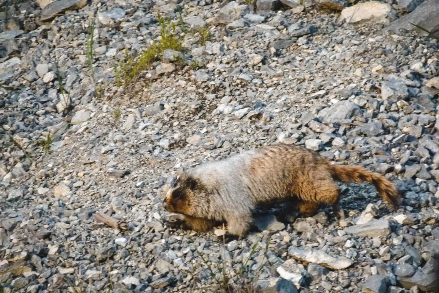
Ha Ling Peak citizen – marmot who hiked with us for a while
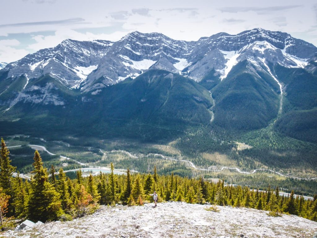
Once you reach the top and find yourself on the ridge, you will see the town of Canmore below you. Continue hiking, the mountain summit of Ha Ling Peak is on your left. On a clear day, you can see all the way to Calgary and further into the Bow Valley on the opposite side.
TIP
During spring when the snow is melting, there are several small streams along the trail from which you can drink. I would recommend this only if you’re using Lifestraw bottle with a filter or something similar (to avoid beaver fever and other possible diseases – I’m not overcautious, this happens more often than you think).
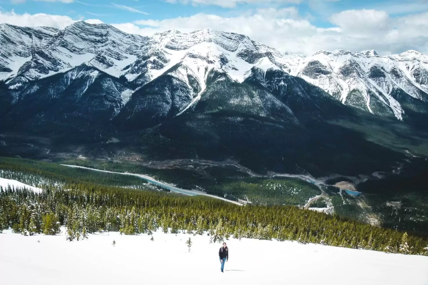
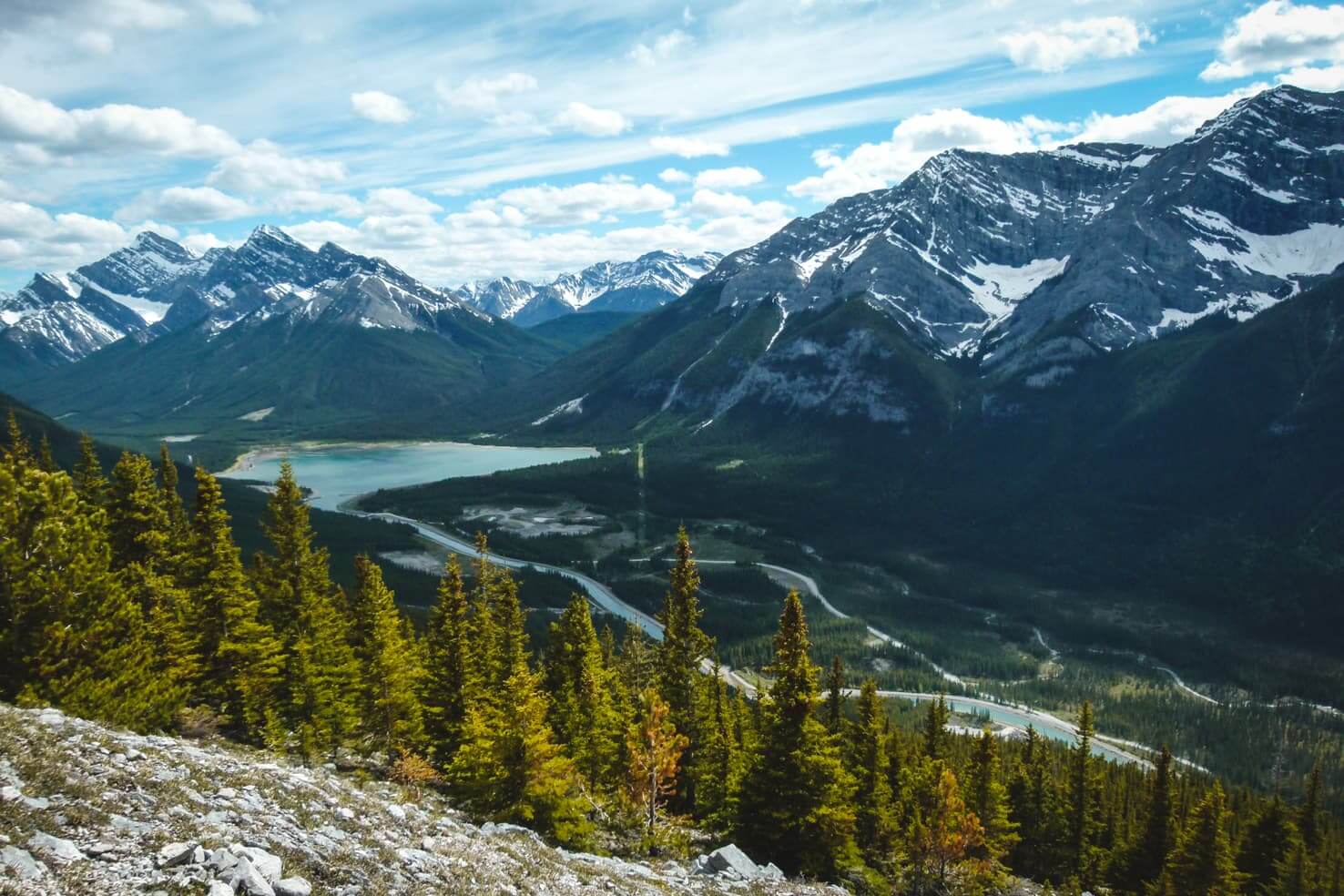
view of Goat Creek and last section of the climb to Ha Ling Peak
Interesting fact about Ha Ling Peak
Why it has a very unusual name Ha Ling Peak? It’s not an English name and it certainly is not a name given by First nation people.
The peak was named after Ha Ling, a Chinese cook for the Canadian Pacific Railway. There was a bet involved that he cannot climb the mountain in under 10 hours, which he did. Of course, nobody believed him, so he led a group up the mountain where he put a big flag, visible from town. In his honour, the peak was named after him.

view from Ha Ling Peak towards Mount Lawrence Grassi
Mount Lawrence Grassi Hike
Mount Lawrence Grassi summary
- 9,8 km return ( ̴ 6 hours)
- Out and back hike
- Elevation gain 1022 m
- Maximum elevation 2722 m
- Best time to go May – October
- Gear: windproof jacket, running/hiking shoes, water, hiking poles

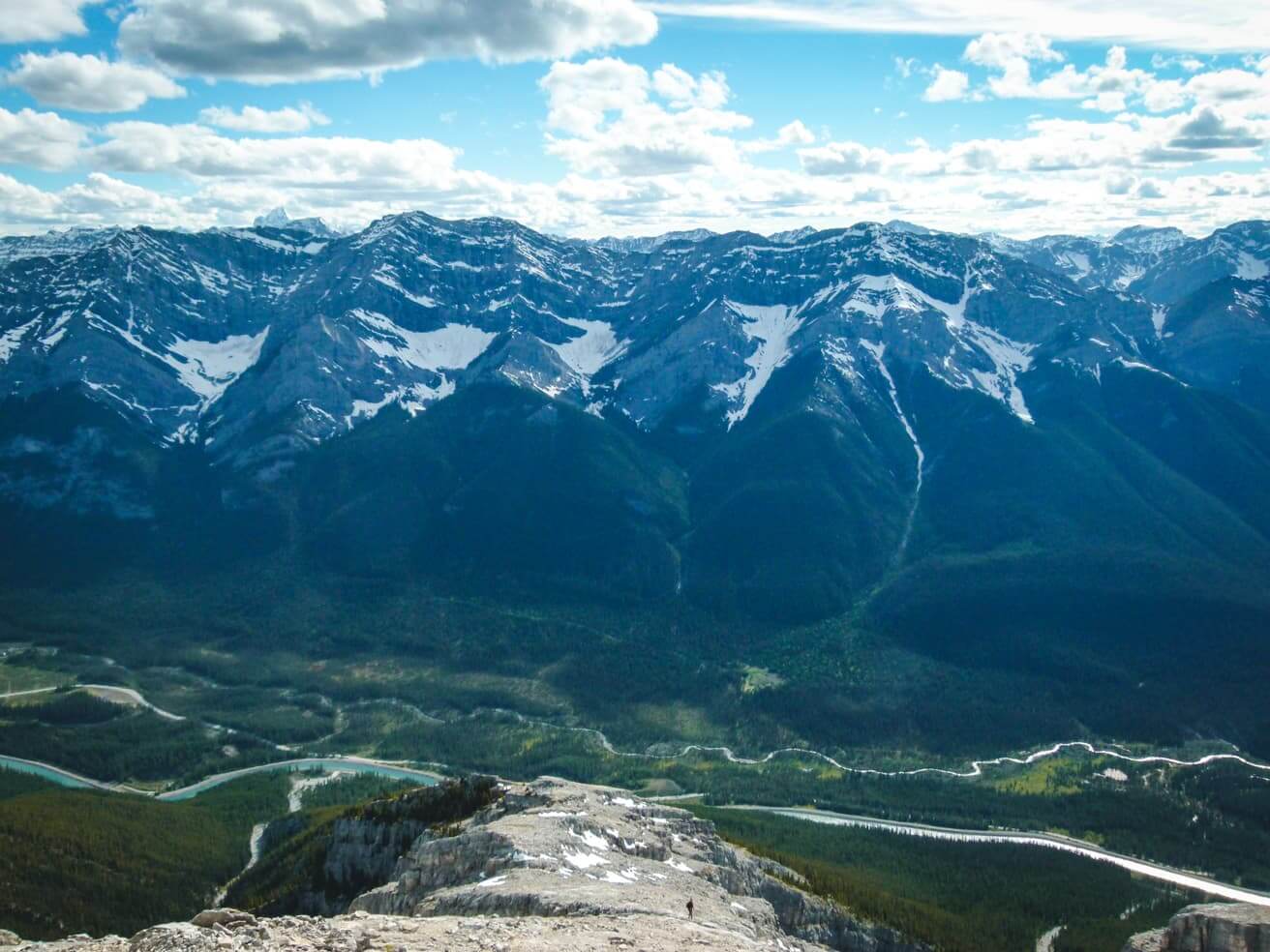
Looking towards Calgary from Mount Lawrence Grassi
Hiking Mount Lawrence Grassi was challenging and rewarding at the same time. It is a very steep climb, you will climb 1000 m elevation gain in just 3 km. This trail wasn’t even on our trail map which we bought in Canmore. Therefore I suppose there are not many people who know about it. We’ve only met two other hikers. If you are in the area, I highly recommend taking advantage of it!

hiking to the top of Mount Lawrence Grassi with a view of Goat Pond and Goat Mountain
Directions to Mount Lawrence Grassi
This is a neighbour of Ha Ling Peak. Trailhead parking is the same as for hiking Ha Ling Peak – at the Goat Creek Day Use Area. From the parking lot, head across the road, up the small hill and cross the canal.
You will pass the starting point for Ha Ling Peak and continue along the canal for another ̴ 2 km until you see a cairn (pile of rocks) on the left. At this point, you will enter the forest where you can see the trail to Mount Lawrence Grassi.

the trail along canal to the starting point of Mount Lawrence Grassi hike
Mount Lawrence Grassi Trail
Keeping right, follow the trail through the trees until you reach a tree line. It leads to a creek bed – flood washed away a section of the trail. Follow the creek bed until you see a cairn on the left side marking the trail. Just keep hiking up until you start clearing the tree line.
-

- hiking above the treeline
-
- steep climb to the top of Mount Lawrence Grassi
Last 2 km is wide open with great views of Three Sisters, Rundle, Goat Creek, and Ha Ling Peak. You scramble this section on steep rock slabs and gravel. This section on the rocky plateau is not marked or well beaten so you just follow the easiest route up.
Make sure you bring poles! If you don’t need them for hiking up, you will need them going down – your knees will thank you.
Can you spot Michal on the trail?
Interesting fact about Mount Lawrence Grassi
The mountain is named after Lawrence Grassi, an Italian miner who immigrated to Canada in 1912. Lawrence worked for Canadian Pacific Railway, and in the Canmore coal mines afterward. He became a well-known climbing guide who built many of the trails around Canmore, including Grassi Lakes Trail (which is on the way to the parking lot for hiking Ha Ling Peak and Mount Lawrence Grassi).
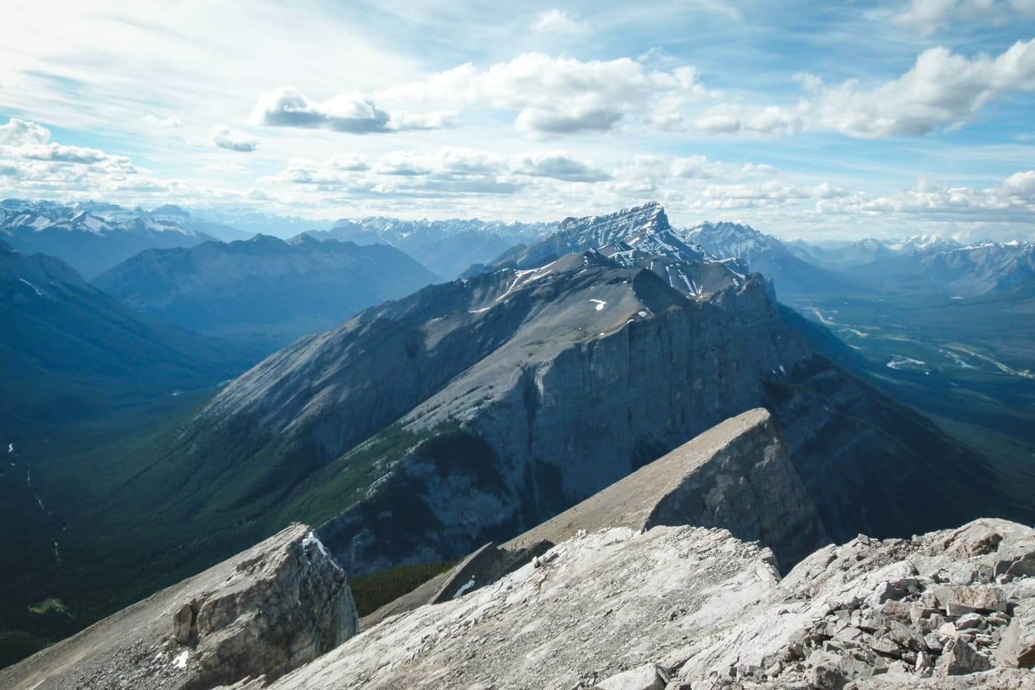
Looking towards Ha Ling Peak from Mount Lawrence Grassi
More hiking ideas in the Canadian Rockies:
- 20 best hikes in Banff National Park
- Hiking in Yoho National Park
- 17 best hikes in Jasper National Park
- Alpine adventure at Lake O’Hara, Yoho’s hidden gem
Our favourite hikes in the Canadian Rockies
Canmore & Kananaskis:
Banff National Park:
- Sulphur Mountain
- Johnston Canyon in summer and in winter
- Aylmer Lookout
- Glacier Lake
- Mount St. Piran
- Healy Pass
- Boom Lake
- Rockbound Lake
Jasper National Park:
Yoho National Park:
Kootenay National Park
Do you like hiking? Where is your favourite trail? Let us know which one of these did you hike.
Spread the word! PIN this to your Pinterest board.


*In the spirit of full disclosure: Some links in this post are affiliate links, which means that if you purchase through them, we receive a small commission at no extra costs to you. We appreciate your support!


What beautiful hikes! We love hiking, but have not yet made it to Canada. We would love to experience the stunning nature there. Lovely pictures 😉
Thanks Sarah. I hope you will visit Canada one day!