
With plenty of hikes for every level, mesmerizing lakes, glaciers, waterfalls, and wildlife, hiking in Jasper National Park is always inspiring. Our list of best hikes in Jasper is growing every year as we’re coming back for more.
This post includes:
- 20 best hikes in Jasper for all levels
- A wide range of hikes – mountain tops, lakes, waterfalls, glaciers
- A map of trailheads for easy planning
- Our most recommended hikes
- Detailed stats for each hike (distance, elevation, best time to go, hike description, etc.)
- Photos of each hike
Waiting for the snow to melt after each winter is a highly anticipated event. While some hikes in lower elevation can be done in spring, some are better to wait until late spring or early summer to see the gorgeous unfrozen lakes or wildflowers on mountain tops.
Our guide makes it easy for you to decide which hike you will tackle next. And before you leave to explore, read our Jasper travel guide for all essential info about the national park and local travel tips.
TIP
If you’re looking for an adventurous trip and want to have freedom over your day while staying in campgrounds, book a Smile Campervan from us – a budget, family & pet-friendly option.
Going to the Rockies? Read these:
Epic travel guide to Canadian Rockies
Canadian Rockies road trip itinerary

If you’re driving from Calgary, the mountains starting to surround you just shortly after leaving the city and you don’t know where to look or stop first. Driving from Banff to Jasper on the Icefields Parkway, roughly 290 km, can be stretched to more than a few hours.
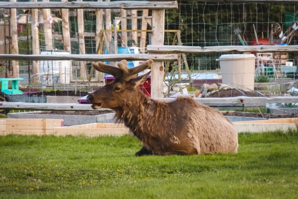
Snow-covered high peaks of the Canadian Rockies, wildlife searching for some food along the highway or signs that invite you to explore lakes and waterfalls. Take time and explore the gems along the Icefields Parkway that the Rockies are famous for.
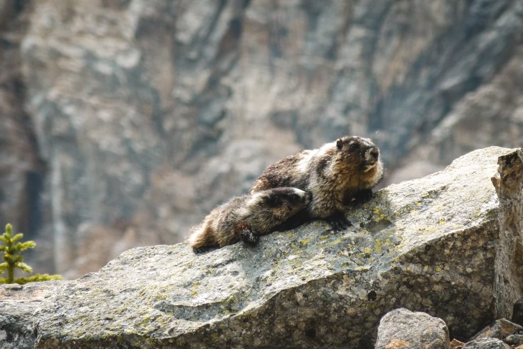
See our post about Canadian wildlife – what you can see and best places to see them.
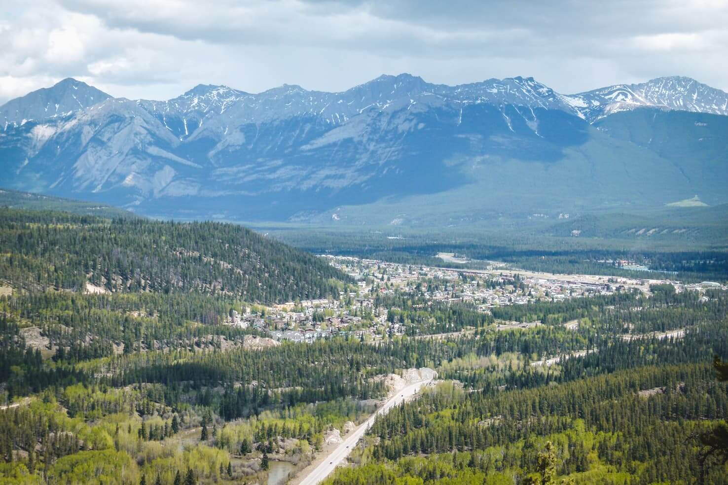
Since our first visit to Jasper, we keep coming back. It is our favourite national park of all in the Canadian Rockies. Since it’s so big, people are spread out through the valley and unlike the neighbouring Banff, it never felt crowded.
Table of Contents
Hiking in Jasper National Park
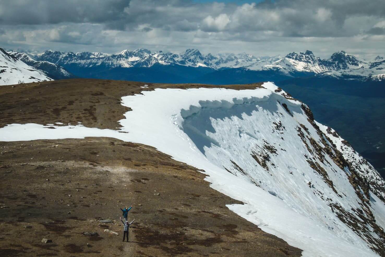
The first time we’ve visited Jasper was in May when (usually) the spring is in full swing. In the Rockies though, this is just the beginning of spring and mountain peaks (and sometimes valleys) are still covered by snow. Many of the lakes in Jasper were still frozen.
Most of these Jasper hikes are located south from town, with a few north from Jasper. Take full advantage of the short hiking season in the Canadian Rockies and explore these hiking trails in Jasper National Park. I’ve listed a lot of hikes to choose from based on your fitness level and time available. Enjoy!


A quick overview of the included Jasper hikes:
Easy hikes in Jasper
- Pyramid Lake hike & Pyramid Island
- Whistlers Mountain Hike
- Lake Edith & Lake Annette Hike
- Valley of the Five Lakes
- Maligne Canyon
- Horseshoe Lake
- Athabasca Falls
- Maligne Lake Hike
- Mona Lake & Lorraine Lake
- Moose Lake Loop
- Sunwapta Falls
- Stanley Falls
Moderate hikes in Jasper
- Whistlers Mountain Hike (it’s moderate if you don’t take the gondola up the mountain)
- Indian Ridge
- Jacques Lake
- Edith Cavell Meadows
- Bald Hills Trail
- Wilcox Pass
Difficult hikes in Jasper
- Snake Indian Falls
- The Sulphur Skyline Hike
- Skyline Trail
Best day hikes in Jasper – our favourites
- Valley of the Five Lakes
- Edith Cavell Meadows
- Bald Hills
- Wilcox Pass
- Snake Indian Falls (for mountain biking)

More hiking in the Rockies:
- 20 best hikes in Banff National Park
- Hiking in Yoho National Park
- 15 day hikes near Calgary with jaw-dropping views
- Guide to hiking Lake O’Hara, Yoho National Park
20 best hikes in Jasper
The below Jasper hikes are listed based on the distance from the Jasper town to the trailhead, from closest to the furthest.
1. Pyramid Lake hike & Pyramid Island
Distance: 2 km along the lake’s shore or 5.2 km one-way to the viewpoint
Elevation gain: 200 m if hiking to the viewpoint
Difficulty: easy
Best time to go: year-round
Hike description: One of the many lakes near Jasper’s townsite is Pyramid Lake. It’s the biggest one which can be accessed from town without a car. With its neighbour Patricia Lake, they lie at the foot of Pyramid Mountain, a landmark that overlooks the town of Jasper.
Take an easy stroll around the lakes, watch for wildlife or million stars at night. Jasper is officially Dark Sky Preserve, an area where almost no artificial lighting is visible at night. It’s celebrated during the Jasper Dark Sky Festival in October, on the Pyramid Island.

The most enjoyable activity for us was mountain biking around Pyramid Lake and other lakes, stopping for a quick cool off in the lake and having a picnic on the Pyramid Island.
For the Pyramid Lake viewpoint, start hiking at the parking lot for Jasper Activity Centre. Afterward, you can rent a canoe or kayak and paddle across the lake. Winter offers snowshoeing & cross country skiing trails and sleigh rides.
Distance from Jasper to trailhead: 6 km

2. Whistlers Mountain Hike
Distance: 18 km round trip for hikers & 4 km round trip to the summit for visitors taking the Sky Tram
Elevation gain: 1,200 m elevation gain (for hikers)
Difficulty: easy (moderate for hikers)
Best time to go: usually June to September, check trail conditions for avalanche danger if hiking in early spring. Hiking up the Whistlers Mountain wasn’t an option for us because of the avalanche danger in May.
Hike description: The most popular hike in Jasper National Park is climbing up the Whistlers Peak. The trail to the top and the Sky Tram is located just 6 km from Jasper. When you go from Jasper, take Highway 93 (Icefields Parkway) south for 2 km, turn right on the Whistler’s Road 3 km until you reach the parking lot.
There are 2 options how you can get to the top of the Whistlers Mountain:
- You can hike the steep trail in full length of 9 km with a gain elevation of 1,200 m and pass through all three of the park’s life zones. The trail starts near the west end of the parking lot. The switchbacks are gradually going up until the steepest section just before you reach the Whistlers summit. Once you hike above the tramway terminal, you will have a 360° panoramic view.
- The easier way is going up with Sky Tram which will take you 2 km from the top. You will hike about 20 minutes to reach the summit of Whistlers Mountain. The Sky Tram opens in March for the season and it’s the only way of going up until June because of the avalanche areas that the trail passes. It costs 52 CAD (in 2020) and you can book tickets online. (They don’t offer any discount if you want to hike up and take the Sky Tram down.)
The top of the mountain rises to 2,470 m above sea level and offers panoramic views of the Jasper National Park. Peak finder on top will help you name surrounding peaks, including Mount Robson, the highest peak of the Canadian Rockies at 3,954 m.
Distance from Jasper to trailhead: 6.6 km
3. Indian Ridge
Distance: 13 km from Sky Tram
Elevation gain: 975 m
Difficulty: moderate
Best time to go: June to September
Hike description: If you continue past the Whistlers Peak and leave the crowds behind, you will be rewarded by the endless mountain views and solitude. The trail is a scramble in parts as you hike on loose rocks and should be attempted by only by experienced hikers.
With a beautiful Pyramid Mountain behind you, you will see Mount Robson in front of you rising high above all other peaks. If you decide to pay the steep price for the Sky Tram, make it worth it and explore the mountain ridge as much as you can beyond the Whistlers Peak.
Distance from Jasper to trailhead: 6.6 km
4. Lake Edith & Lake Annette hike
Distance: 2.4 km loop around Lake Annette
Elevation gain: almost no elevation
Difficulty: easy
Best time to go: year-round
Hike description: The short loop is around Lake Annette and it can be extended if you take the Bighorn Alley, a hiking/biking trail leading from Jasper to the lakes.
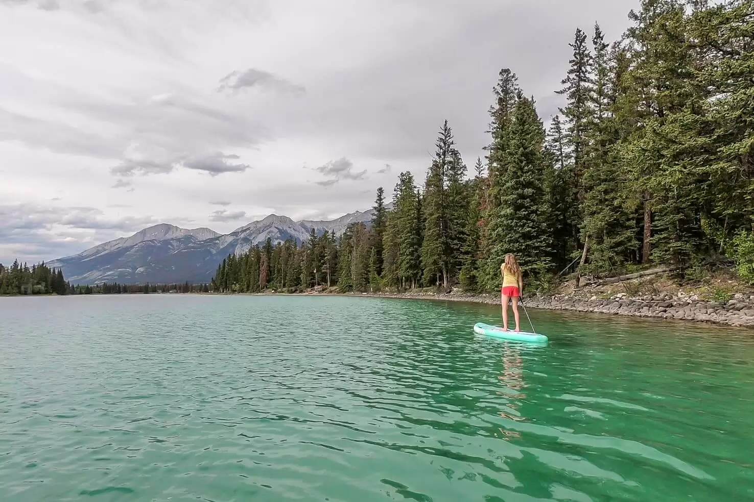
The blue-green coloured lakes can be enjoyed from the canoe, kayak or stand up paddleboard which you can rent on the sandy beach. These two lakes are shallow and quite warm, considering the usual ice-cold water in big lakes, so you can enjoy a swim. There are also plenty of BBQ grills and picnic tables in the area.
Distance from Jasper to trailhead: 9 km
5. Valley of the Five Lakes
Distance: 5.5 km (short loop); 9.5 km (long loop)
Elevation gain: 100 m (short loop)
Difficulty: easy
Best time to go: year-round
Hike description: One of the most popular hikes due to its proximity to Jasper, easy trails and astonishing lakes. It’s also one of our favourite easy hikes in Jasper. The trailhead begins just off of the Icefields Parkway.
Hiking along the five lakes can take anywhere from 1-3 hours. We were so amazed by the shades of jade and blue, that we had to stop very often to enjoy it to the fullest. So every time you pass another lake from a different side, notice the change of the colour.

The hike starts with a walk through the forest, crossing the bridge over the Wabasso Creek. Soon after there is a junction for starting the circuit. Whichever path you choose, make sure to visit all five lakes. You will be astonished.
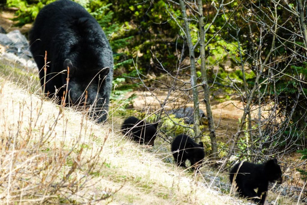
As we visited in spring, where not only nature but wildlife comes to life, we were lucky to see many mountain goats and bears with cubs. Truly an unforgettable experience!
Distance from Jasper to trailhead: 10.6 km south of Jasper
Read the full blog post: Valley of the Five Lakes
TIP
Don’t have enough time for all hikes? Read our Jasper itinerary for 4 days which covers the highlights of the park.
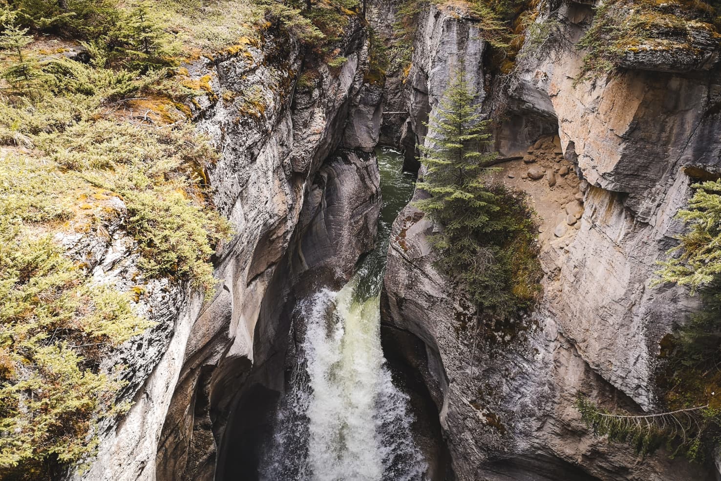
6. Maligne Canyon
Distance: 6 km
Elevation gain: 100 m
Difficulty: easy
Best time to go: year-round
Hike description: Maligne Canyon is one of the most interesting canyons in the Canadian Rockies. It is fed by the Maligne River from Maligne Lake. There are six bridges built to help explore this magnificent canyon. Many trails are found along the way, starting near each of the bridges. I would recommend hiking through all six bridges and enjoy spectacular and changing views.
To get to the Maligne Canyon trailhead, follow Highway 16 to Edmonton. Go 2.5 km past the Jasper exit and follow signs to Maligne Canyon.
Distance from Jasper to trailhead: 11 km north from Jasper
7. Edith Cavell Meadows
Distance: 8 km loop (or 1.6 km return if you hike to the glacier viewpoint only)
Elevation gain: 500 m
Difficulty: moderate
Best time to go: mid-June to September
Hike description: A very popular hike where you can easily hike up close to the glacier. It is in a very fragile area – the road leading to the trail opens mid-June and Parks Canada required to purchase a permit to access it. Thanks to the improvements they made, there will be no permit required from summer 2019. Yay!

Driving south from Jasper on Icefields Parkway, once you pass the Wapiti Campground on the left, you will take the next right to 93A. Then take the 2nd right to Mount Edith Cavell Road and up the switchbacks, there is a big parking lot at the end of the road and also public toilets.

The Cavell Meadows trail to see the Angel Glacier is the easiest part. Then hike the hill that’s directly behind you to get the best views from the top. The steep trail up the scree is less frequented but the views are well worth the effort. We both loved this hike. If you only have time for one hike in Jasper, make it this one.
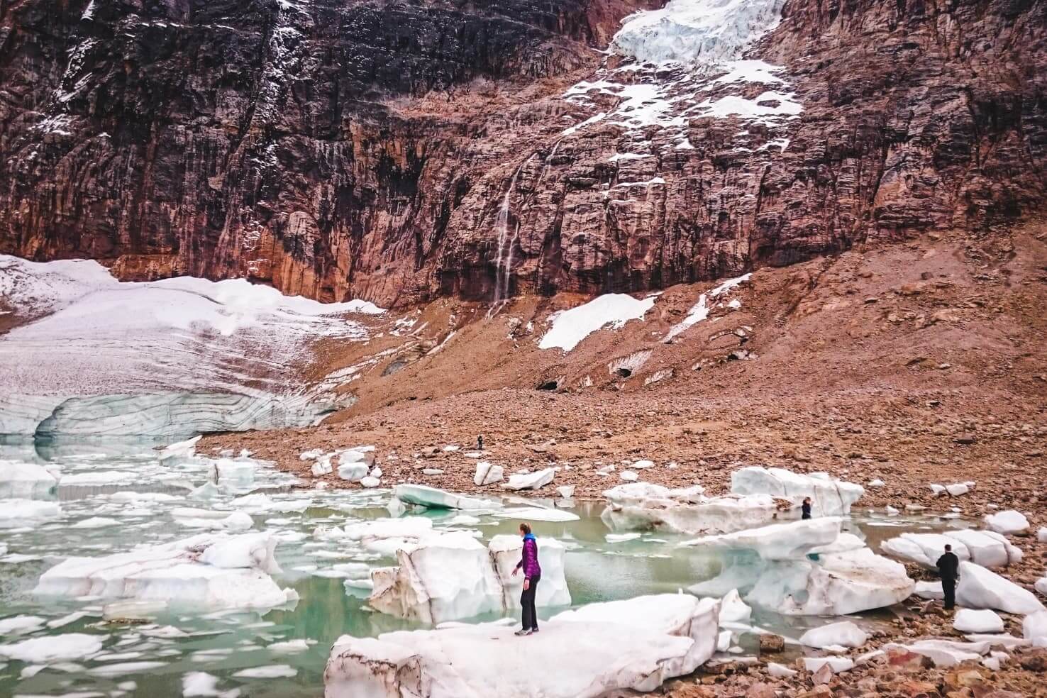
Distance from Jasper to trailhead: 25 km south of Jasper
8. Horseshoe Lake
Distance: 1.5 km
Elevation gain: no elevation
Difficulty: easy
Best time to go: year-round (great for stand up paddleboarding in summer and ice skating in winter)
Hike description: Visiting Horseshoe Lake is not so much about hiking as it is about cliff diving. The lake is just off of the Icefields Parkway and after a short walk through the forest; you will have the option to hike around it.

We didn’t even hike around because we came for the cliff diving. Since the rock walls around the lake have different heights, it’s easy to choose from 1 to 20 meters. The crystal clear water and amazing green colour of the lake are very inviting. The water is incredibly cold even during summer but the adrenaline from cliff jumping is contagious.

Just a word of caution: If you haven’t cliff dived before, make sure you work your way up from the smallest cliff to the bigger ones. One guy injured his back when we visited because he jumped from one of the highest cliffs with no previous experience and his friends had to call an ambulance. It’s not a dangerous activity as long as you gain experience before trying to show off to your friends.
Distance from Jasper to trailhead: 28 km south of Jasper
TIP: If you are not a fan of ice cold water, no worries. Visit Miette hot springs near Jasper.

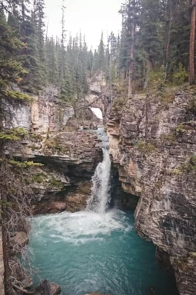
9. Athabasca Falls
Distance: 1 km
Elevation gain: no elevation
Difficulty: easy
Best time to go: year-round
Hike description: A gorgeous and very strong waterfall with a mountainous background. The short paved trail with a bridge leads to the lookout point of the falls. You can access it all year round and there is no fee. The area has picnic tables and toilets.
Distance from Jasper to trailhead: 32 km south of Jasper

10. Jacques Lake
Distance: 24.4 km
Elevation gain: 240 m
Difficulty: moderate
Best time to go: June to September
Hike description: The trailhead to Jacques Lake is signed next to the Medicine Lake along the Maligne Lake Road. This is a perfect 2-day backcountry trip for beginners with a simple campground by the lake. The trail passes 4 lakes and about half of it can be done on mountain bikes.
Distance from Jasper to trailhead: 32 km
11. Snake Indian Falls
Distance: 54 km
Elevation gain: 1,500 m
Difficulty: difficult
Best time to go: late June to late September
Hike description: A truly off the beaten place in Jasper National Park. The trail leads mostly through the forest with an occasional trail along the river but the reward at the end is spectacular. Hikers do this in a few days and camp at the waterfalls, we’ve biked to the falls and had a great day trip with no people on the trail.

To get to the trailhead, drive towards Snaring River Campground and continue on the Celestine Lake Road. The 2nd half of the road is restricted to certain times for inbound and outbound traffic. All the directions to the trail, rules, and tips our in our post about Snake Indian Falls.
Make sure to check the trail conditions in Visitor’s Centre before you go as part of the trail is prone to flooding each spring.
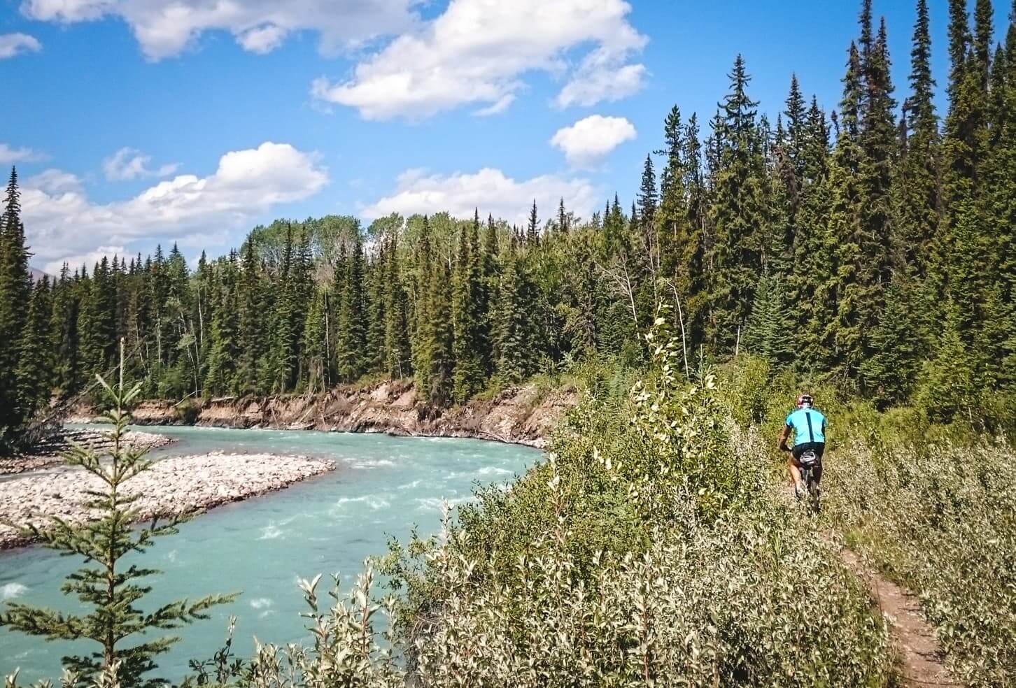
Distance from Jasper to trailhead: 42 km north of Jasper
12. The Sulphur Skyline Hike
Distance: 8 km
Elevation gain: 650 m
Difficulty: difficult
Best time to go: June to September
Hike description: The trailhead is located next to the Miette Hot Springs and easy to find. Prepare for a burn in your legs from the beginning. The steep 4 km trail to the top is the best way to work that legs though. When you reach the mountain top, you will be surrounded by panoramic views of mountain peaks.
Distance from Jasper to trailhead: 44 km from Jasper
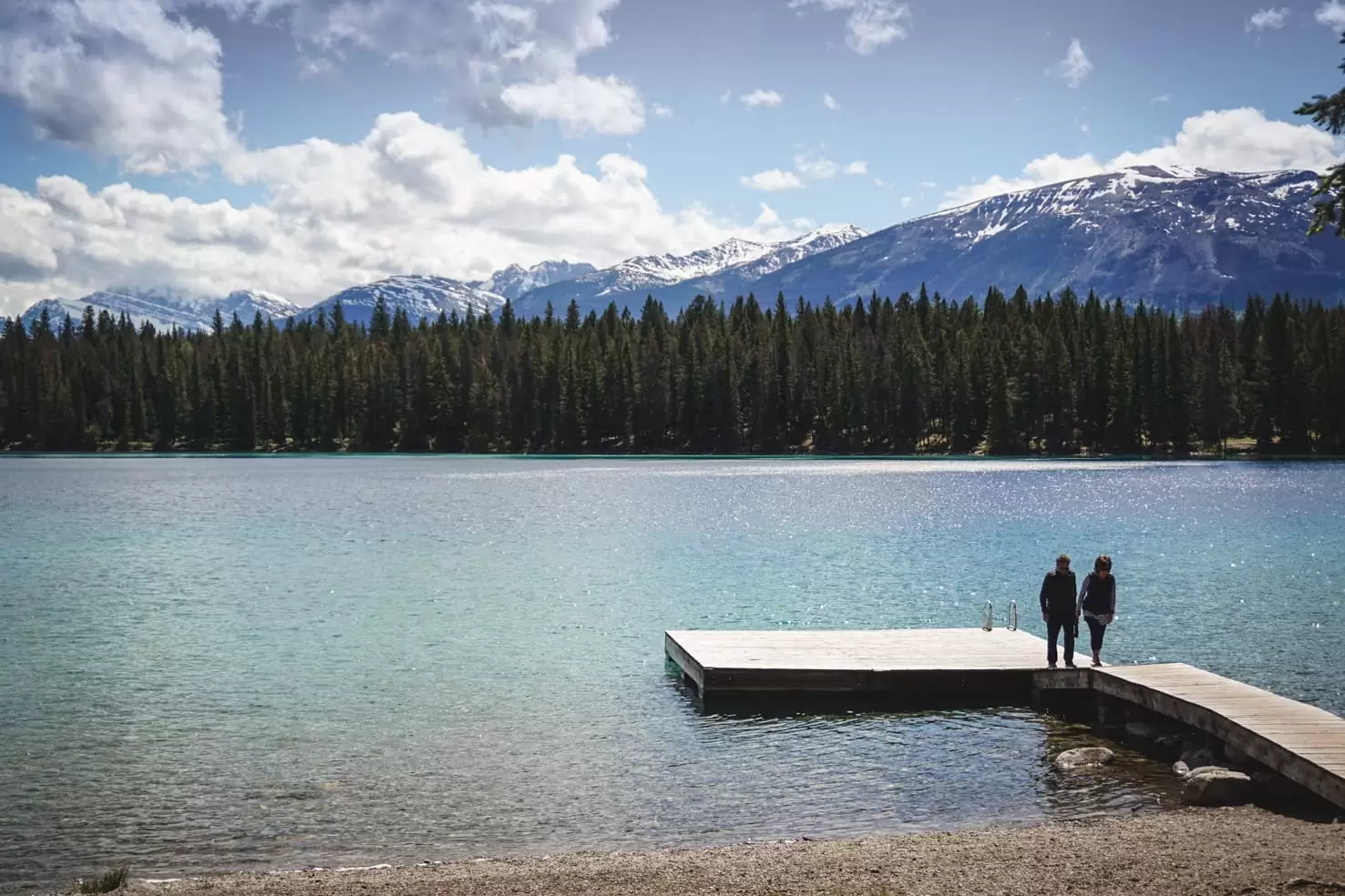
13. Mary Schäffer Loop Hike
Distance: 3.2 km loop
Elevation gain: 25 m
Difficulty: easy
Best time to go: May to October
Hike description: The longest natural lake in Canada is 23 km long and popular for hiking, kayaking, and canoeing. It’s well-known for its changing colour, depending on the angle sun rays touch the surface.
Walk along the shore of the lake on Mary Schäffer Loop and notice the changing colour. You can also paddle across the Maligne Lake, spend the night camping by the shore with a view of the photographer’s favourite picturesque Spirit Island.

Maligne Lake with a view of surrounding peaks and three glaciers make it the most popular spot in Jasper National Park. There are plenty of hikes to suit every fitness level including these 3 below.
Distance from Jasper to trailhead: 45 km south-east of Jasper (starting at Maligne Lake)
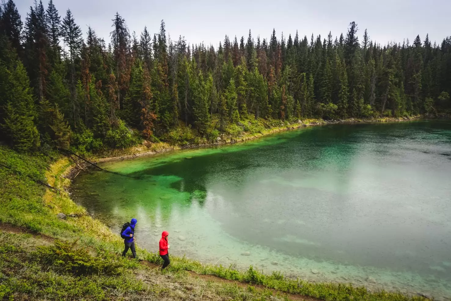
14. Mona Lake & Lorraine Lake
Distance: 5 km
Elevation gain: 90 m
Difficulty: easy
Best time to go: May to October
Hike description: The easy trail to Mona and Lorraine Lakes leads through the forest and starts past the bridge over Maligne River. If you are not a fan of crowds, this easy trail is a perfect escape. Although the trail is not very scenic, once you reach the lakes, the beautiful mountain view opens up. It takes around two hours return.

After a long day spent hiking, there is nothing better than relax your feet in a chilly lake. When you are sore or very brave, you can always take a quick dip.
Distance from Jasper to trailhead: 45 km south-east of Jasper (starting at Maligne Lake)
TIP
Are you planning a trip to Jasper? Make sure to read our huge bucket list of 65 things to do in Jasper. I’m sure it will give you a lot of new ideas!
15. Bald Hills Trail
Distance: 10 km
Elevation gain: 500 m
Difficulty: moderate
Best time to go: June to September
Hike description: Another hike starting at the Maligne Lake (but not a flat one). Pass the Maligne Lake Lodge on your left, continue across the Maligne River and park on the left-hand side parking lot.
The trail to Bald Hills starts on the fire road behind the gate. You will be hiking on an old fire road, then a short steep section and the hill with views at the end. The reward of Maligne Lake panorama and surrounding peaks is breathtaking. The top of the hills reaches 2,300 m. A similar hike is just on the other side of the river called Opal Hills.
Read the full blog post: Bald Hills Hike
Distance from Jasper to trailhead: 45 km south-east of Jasper (starting past the Maligne Lake)

16. Moose Lake Loop
Distance: 2.7 km loop
Elevation gain: 50 m
Difficulty: easy
Best time to go: May to October
Hike description: The easiest and shortest hike in the Maligne Lake area is an easy loop around Moose Lake (trailhead starts at the parking lot for Bald Hills). It’s a small and picturesque lake with occasional moose roaming around (hence the name). It’s frequented by many visitors so I would recommend visiting early in the morning to avoid the crowds.
Distance from Jasper to trailhead: 45 km south-east of Jasper (starting past the Maligne Lake)

17. Skyline Trail
Distance: 44 km
Elevation gain: 1,800 m
Difficulty: difficult
Best time to go: July to September
Hike description: Skyline Trail is one of the top backpacking trips in the Canadian Rockies because almost two-thirds of the trail goes above the treeline. Climbing over three mountain passes, it is usually done in 2-4 days although some strong trail runners complete it in a day. Campgrounds along the trail need to be booked in advance here and sell out fast. Make sure to book in January when it opens or check back for cancellations.
Distance from Jasper to trailhead: 48 km from Jasper (starting from Maligne Lake or 2 km if starting from Signal Trailhead)
18. Sunwapta Falls
Distance: 700 m to Upper Falls; 2.2 km roundtrip & 90 m elevation to Lower Falls
Elevation gain: no elevation
Difficulty: easy
Best time to go: year-round
Hike description: Sunwapta Falls is a very popular and free attraction along the Icefields Parkway. The 18m high waterfall with mountain peaks in the background. From the parking lot, you will walk 700 m on the paved trail and cross the footbridge for the best view the upper falls. To see the lower falls, follow the trail through the forest for around 1 km and then down the steep section for the better view of the three waterfalls.

There is also a restaurant at the mountain lodge and picnic tables in the area. Visit in the late spring when the flow is the strongest due to the melting snow.
Distance from Jasper to trailhead: 55 km south of Jasper
19. Stanley Falls
Distance: 4.5 km
Elevation gain: 40 m
Difficulty: easy
Best time to go: June to October
Hike description: A relatively little known hike on the Icefields Parkway. The trailhead starts at the very small unmarked parking lot on the right side (when driving from Lake Louise to Jasper), 6 km from Stutfield Glacier viewpoint.
The easy trail following the creek takes you through the forest until you reach a canyon. It is a beautiful and quiet place with many cascading waterfalls. We haven’t met a single person when we visited during the weekend.
Distance from Jasper to trailhead: 89 km south of Jasper
20. Wilcox Pass
Distance: 8 km one-way (or 8 km roundtrip if you follow our footsteps)
Elevation gain: 425 m
Difficulty: moderate
Best time to go: May to October
Hike description: The trailhead to Wilcox Pass starts along the Icefields Parkway right next to the Wilcox Creek Campground before your reach Columbia Icefield.
From the parking lot, you will pass the trailhead kiosk and continue on the wide and well-trodden trail leading uphill through a forest. Shortly, you will leave the forest behind and hike with a view of the Athabasca Glacier on the other side of the Icefields Parkway.

Once you reach the area above the tree line, the typical red chairs are waiting for you to take a break and enjoy the view of the Athabasca Glacier. Continue into the valley where different tundra-like landscape awaits.
Read the full blog post: Wilcox Pass Hike

Distance from Jasper to trailhead: 107 km south of Jasper (127 km from Lake Louise)
Mountain views of Jasper National Park, ice-cold lakes in more shades of blue and green you can imagine and plenty of wildlife were highlights of our trip.
Hiking in Jasper National Park is always full of surprises and with the park having so many activities to offer (mountain biking & stand up paddleboarding being our favourites), we’re back every season.
Know before you go
What to pack
- Read our recommendations in our Hiking packing list for summer in the mountains
- We highly recommend purchasing a good hiking map for Jasper & Maligne Lake in advance. Visitor Centres are usually sold out in the high season. We never hike without a map, better be safe than sorry.
Staying in Jasper National Park
To have the most freedom and enjoy nature to the fullest while staying on a budget, we always recommend staying in the campgrounds. Jasper National Park has many of them with picturesque scenery (glacier view anyone?). Read our comprehensive guide about Camping in Jasper National Park for all camping info and lots of pictures of the campgrounds.
National park fees
When you enter any national park in Canada, you’re required to pay an entrance fee. You have a choice of either a daily pass or a yearly pass.
As of 2020, the fees are:
- 10 CAD per person for a daily pass, 20 CAD for a group/family
- 69.19 CAD per person for a yearly pass, 139.40 CAD for a group/family
The yearly Discovery Pass is valid for all National Parks in Canada. You can purchase it at the gate when you enter the national park, in the Visitor’s Centre or online here.
TIP
If you haven’t ordered your park pass online in advance, when driving from Calgary, stop at the visitor centre in Canmore along Trans-Canada Highway. It will save you a lot of time at Banff National Park gates where you can spend hours in summer.

Road closure
For trail closures due to wildlife presence or avalanche dangers in Jasper National Park, check out the report from Parks Canada.
Accurate road conditions can be checked here.
Trail report
Before you go hiking, check current trail conditions on Trail Report from Parks Canada.
Bear country
As always in the Canadian Rockies, you are in bear habitat. You should always carry a bear spray (can be purchased at Visitor’s Centre or outdoor stores), know when and how to use it and make noise while hiking and running (so you don’ surprise any bears)! Carefully read these instructions on how to behave around them.
*In the spirit of full disclosure: Some links in this post are affiliate links, which means that if you purchase through them, we receive a small commission at no extra costs to you. We appreciate your support!
Read more about the Canadian Rockies
Adventure travel guide to Banff National Park
Best time to visit Banff National Park
With so many Jasper hikes to choose from, which one is your favourite?
Spread the word! PIN this to your Pinterest board.


Jasper National Park looks an amazing place to hike. There is certainly some magnificent scenery there. I like the look of Mona Lake and the snow capped mountains in the background. So lovely
So many beautiful national parks in Canada, it’s really hard to choose which one to visit.
We were there last year and only had time to hike Maligne Canyon which was fun. Inspired me to return and do a few more hikes when we return to Canada.
Yes, definitely return. There is so much to explore in this park. One of my favourites!
Jasper is such an awesome spot! Several of these spots are still on our to do list:) Have you tried Maligne Canyon in winter? Supposed to be pretty spectacular.
Inger
Yes, I love Jasper! Haven’t visited in winter yet. But I’ve seen too many gorgeous pictures, so might visit this winter and go cross country skiing. When are you heading back?
We love hiking and Jasper looks like a superb place to indulge our hobby! I’ve not yet visited Canada. Thanks for sharing your gorgeous photos 🙂
Thank you Stephanie! Jasper really is an awesome place for hiking. What is your favourite place?
If there was anywhere else in my beloved Canada that I’d love to hike, other than in my home of Ontario, it would definitely be out west!
Beautiful country we live in!